Turkey Ecological corridor landscape
位置:土耳其
分类:公共环境
内容:
设计方案
图片:13张
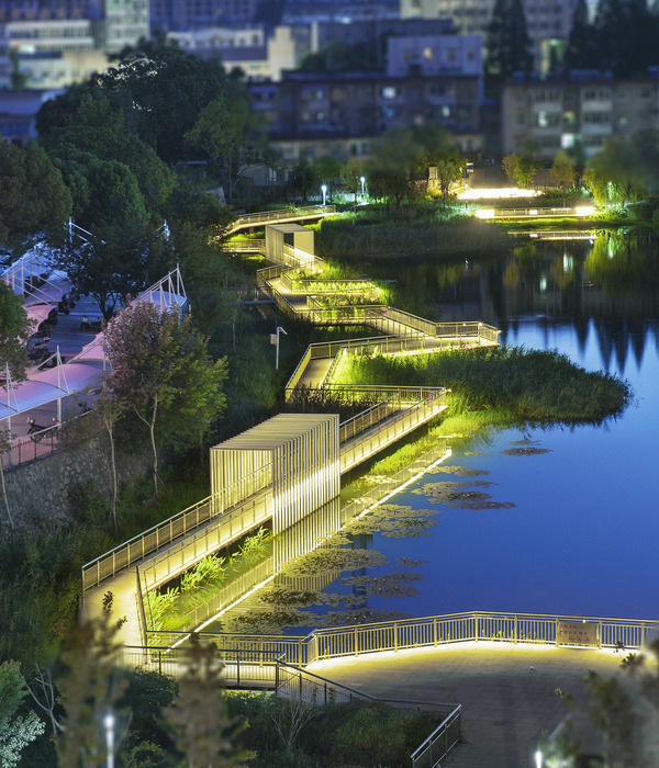
该项目场地位于土耳其中部城市Sivas,这里属于土耳其的Greater Anatolia区域。设计团队对场地的地势特征和周边环境做了详细的了解,在繁华的都市环境中,设计师们希望能够有更多大自然的元素出现。项目场地是该地区人口最集中,人流量最大的地方,这片区域被Kizilirmak河流分成两半,Kizilirmak河流是土耳其最长的河流,但是该河流也一直是两边区域不能成为整体的主要障碍。
在该项目中,设计团队仍旧保持了河流周边的自然状况,但是利用现代化的洪水缓释技术来解决可能发生的洪涝灾害问题,同时也能够对这片场地进行改造。由于冰雪融化造成的河水流量和水平面的季节性波动是该团队考虑的首要问题。只要泛滥平原能够保持稳定,河滨区域便能够着手发展,周边系列的人行步道就能够顺利建造,人们可以沿着长廊散步,欣赏美丽的水景。
译者:蝈蝈
A combination of geographical features has seen the city of Sivas remain one of the greatest focal points of settlement and transit in the Greater Anatolia Region of Turkey. The region is divided in two by the Kizilirmak River, the longest river entirely within Turkey, and it has long been regarded as a barrier to unification.
One of the key objectives of the design was to maintain a stronghold over the flow of the river, using flood mitigation techniques to ensure that the flood problem does not prevent future use of the waterfront. Seasonal fluctuations in the flow and level of the river due to melting snow or extreme heat had to be considered and accounted for. Once the floodplain has been stabilized, the area around the waterfront can be selectively accessed, and a series of pedestrian corridors can bring people back to the riverbank.
土耳其生态长廊景观效果图
土耳其生态长廊景观平面图
土耳其生态长廊景观示意图
{{item.text_origin}}


