Crescent公园,美国 / EskewDumezRipple
该项目属于总体规划的一部分,展示了新奥尔良市区和河滨地区一个新的绿色未来。Crescent公园旨在建立人与河流之间的联系,并将残存的城市工业和海事区域打造成绿色公共社区资源。Katrina飓风的发生为该项目赋予了一个史无前例的契机,让设计师可以重新评估逐渐衰败的河滨同时可以为新奥尔良增添独特的景观和与众不同的街道布局,还可以令历史建筑成为梦想中的当代实用可持续建筑。Crescent公园是新奥尔良30年以来第一个新修的河滨公园,城市需要找回这个地区原始的功能,让人们的关注点回到河流本身,Crescent公园因此而生。
Part of a larger master plan that envisions a new, greener future for the City of New Orleans and its riverfront, Crescent Park was designed to reconnect people with the river and transform the remnants of the city’s industrial and maritime past into a verdant, accessible, community asset. The project was sparked by Hurricane Katrina as an unprecedented opportunity to reevaluate a languishing stretch of waterfront and to supplement New Orleans’ unique character, unusual street grid, and historic architecture with visionary yet practical and contemporary sustainable design. As the first new riverfront park in New Orleans in 30 years, Crescent Park is a response to the need for the city to reclaim its sense of place and origin… a return to the river.
▼概览,overview
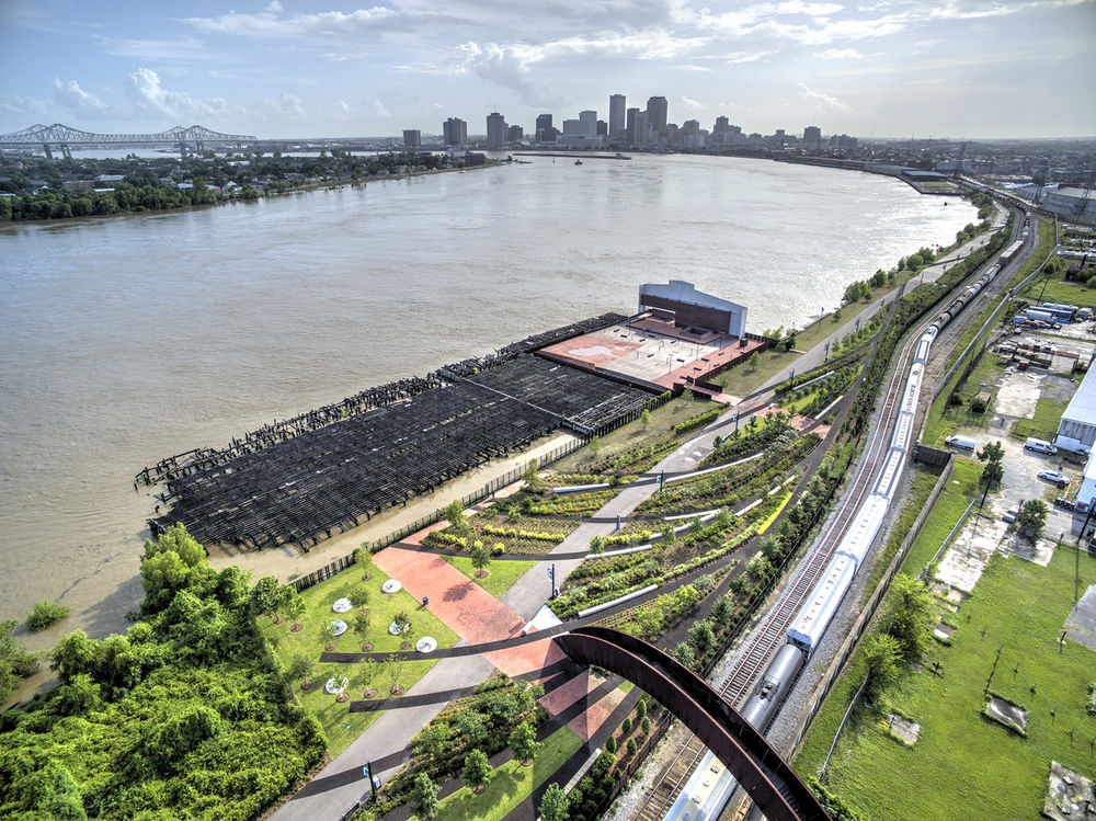
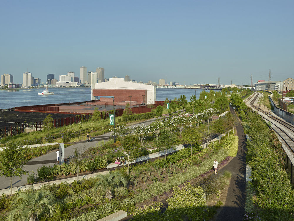
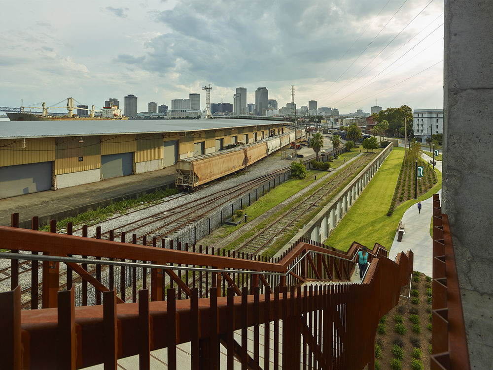
公园里通往河边的道路在空间和视觉设计上都是空前的,为当地居民和来访者营造一个互动的空间,发扬健康、充满活力的生活方式,同时提供了无与伦比的城市天际线景色还有如画的Crescent城市连接大桥景观。
The Park grants unparalleled physical and visual access to the river, creating an environment for locals and visitors to interact and promote a healthy, active lifestyle with unrivaled vistas of the city skyline and the picturesque Crescent City Connection Bridge.
▼公园里通往河边的道路在空间和视觉设计上都是空前的,the Park grants unparalleled physical and visual access to the river
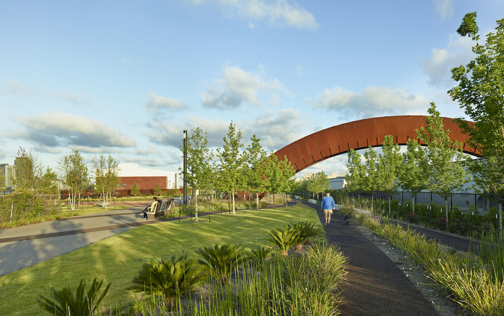
▼无与伦比的城市天际线景色还有如画的Crescent城市连接大桥景观,unrivaled vistas of the city skyline and the picturesque Crescent City Connection Bridge
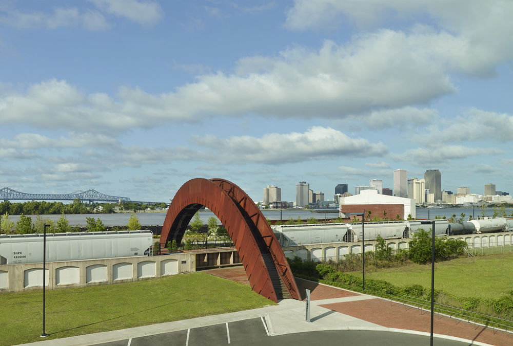
这个1.4英里长的线型公园将海事和工业的棕色地带改造为了20英亩的景观地带。其中的步道网设计可以满足人们散步、慢跑、骑行、野餐和遛狗的需求。该设计也适应性地再利用Piety Wharf和Mandeville Shed两个工业码头,在这里可以举办年度公共集会活动、节日庆典和艺术展览。在新结构的设计中建筑师有意识地结合地块原有的历史和特色,通过现代的手法重新诠释地块的工业历史,向其致敬。在这两个码头原来装卸货的地方,人们可以有约会互动的空间,互相对话、交换想法。新奥尔良跟随许多世界级的城市发展趋势,通过与河道的连接寻求恢复并提升自然环境的机会,同时提升市民的生活质量。
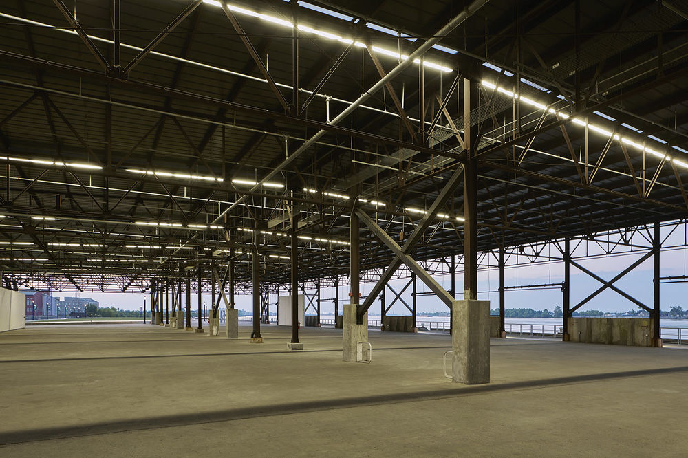
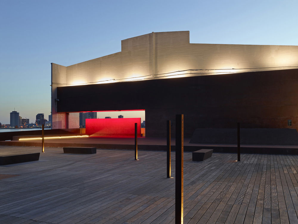
This 1.4-mile linear park repurposes a maritime/industrial brownfield into 20-acres of indigenous landscaping, a network of paths suitable for walking, jogging, and biking; picnic areas, a dog park, and the adaptive reuse of two industrial wharves: the Piety Wharf and Mandeville Shed. Both structures have been stabilized and repurposed to accommodate public gatherings, festivals and the host of artistic exhibitions that take place throughout the year. In lieu of new construction, the architects made a conscious decision to build upon the layers of history and character that already defined the sight. A nod to the industrial past, the repurposing of both structures is a modern reinterpretation. In place of shipping and receiving goods, these two spaces provide opportunities for engagement and interaction, the exchange of ideas and conversation. By reconnecting to the river, New Orleans is following the trend of many world-class cities and exploring opportunities to restore and enhance the natural environment while simultaneously improving citizen’s quality of life.
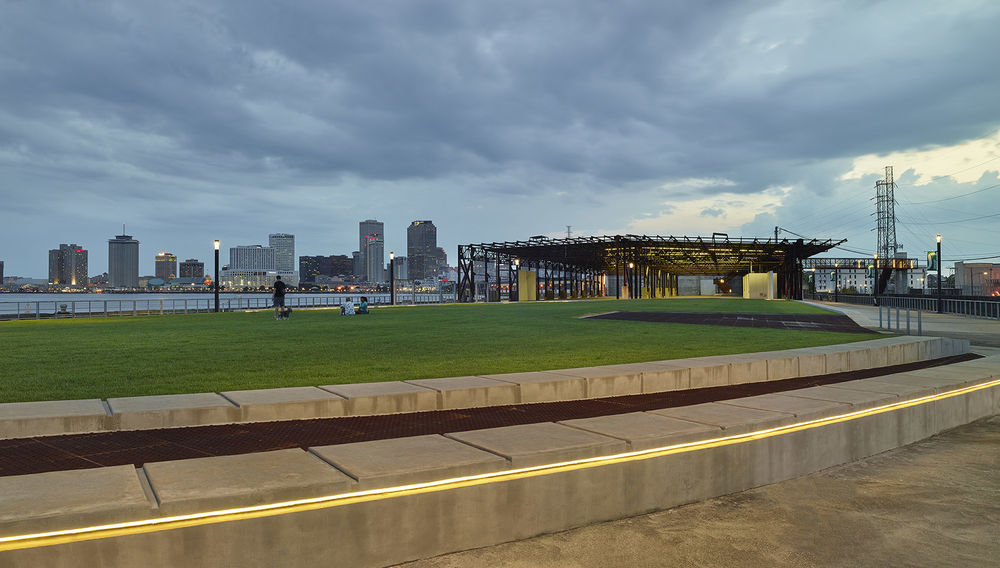
▼在这两个码头装卸货的空间,人们可以有约会互动的空间,互相对话、交换想法,the two spaces for shipping and receiving goods provide opportunities for engagement and interaction, the exchange of ideas and conversation
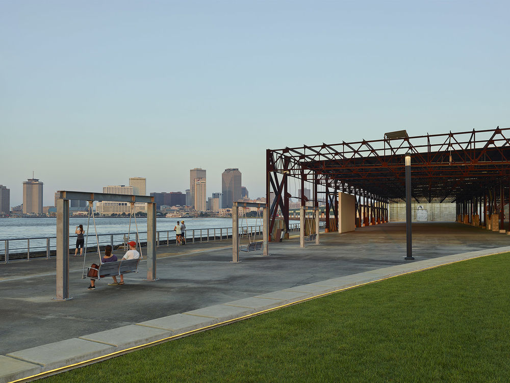

改造后的公园找到了新旧之间的微妙平衡。设计团队丝毫没有掩盖场地的历史痕迹而是在不向后工业衰败遗迹的诗意诱惑和防洪设施妥协的前提下对其进行了强调,最终构建出城市特色的一部分。例如:所有道路的布置轨迹延续了现在不再使用的铁轨线。虽然Marigny和Bywater街区仍被一条运营中的铁道和洪水防御墙隔开,但场地中历史街道网的主要步道让它们之间有了交集。每个交界处都有一个大型的混凝土板来示意街道的名称,用来告知人们所在方位,同时为来访者提供可以欣赏周围环境的座位。
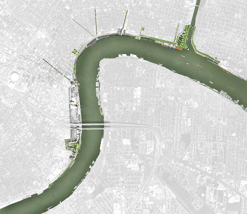
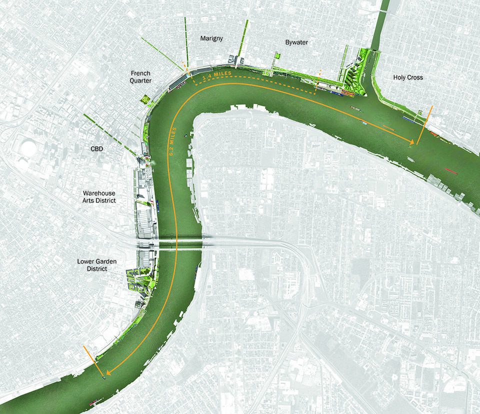
▼规划图,master plan
Evoking a palimpsest, the park is a delicate balance of layering old and new. Rather than eradicate the history of the site, the design team chose to celebrate and build upon it without compromising the allure and poetic ruin of post-industrialization decay and flood infrastructure that ultimately characterizes this part of the city. For example: Inscribed lines of the defunct railroad tracks are the foundation of all the pathways in the park. Though still separated from the Marigny and Bywater neighborhoods via an active rail corridor and flood wall, the site identifies the intersections of the main promenade with the historic street grid. Each intersection is highlighted by a large slab of concrete bearing the street name. This acts as a means of way finding and orientation while inviting visitors to sit and enjoy their surroundings.
▼每个交界处都有一个大型的混凝土板来示意街道的名称,each intersection is highlighted by a large slab of concrete bearing the street name
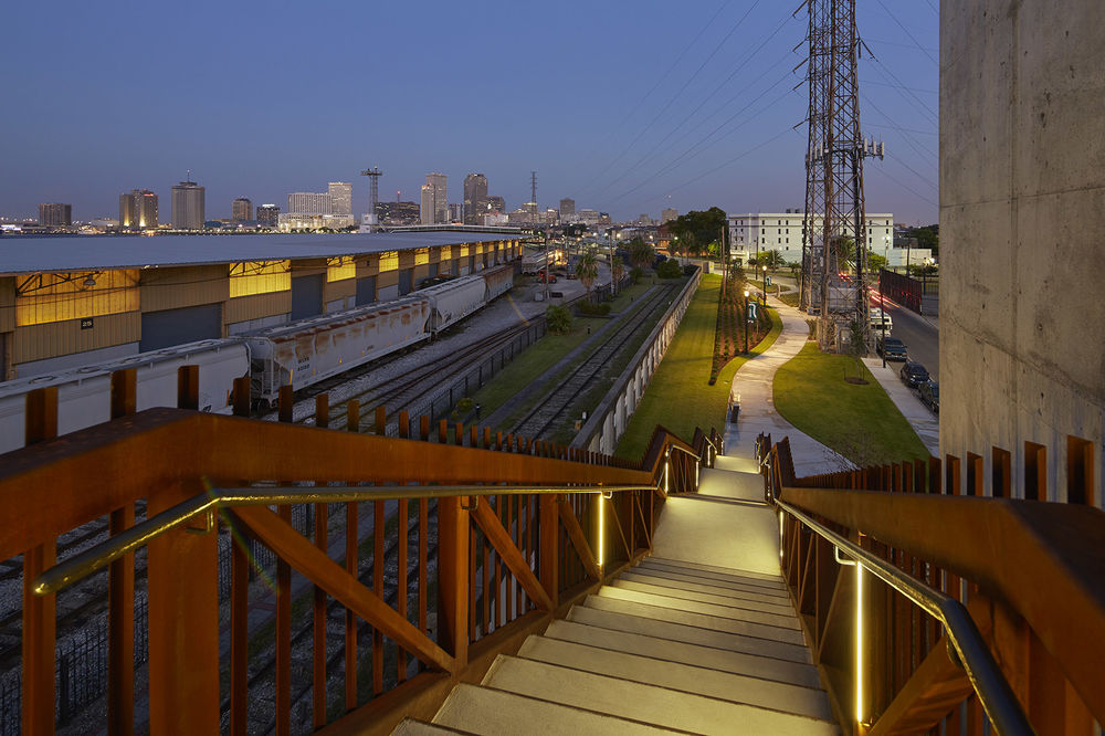
原有的河滨发展规划于2007年完成,沿着密西西比河的东海岸延伸出六英里的距离,将从上游的Jackson Avenue到之前下游工业河道口的Holy Cross学校地区设计成了一个都市中充满活力的美丽河滨,供市民活动使用。这个规划中第一个完成的部分就是Crescent公园,其中通往河边的景致无与伦比,为当地人和来访者创造了一个可以真切感受新奥尔良城市本质的区域。河滨上有不同的景观。在总体规划发展中,广阔的公园一直延伸到场地边缘,小型的社区公园偶尔延伸到其中。这些公园可以通往很多目的地,例如湿地、阳光甲板、露天剧场、网球场和咖啡厅。设计师将城市广场设立在主要的路口,纪念城市历史的同时为市民在新规划中营造一个充满活力的新空间。可持续的街景设计为人们提供了高效的流线,一系列架起的步行道和桥梁让人们不再受防洪墙和火车道的阻挡,可以亲眼看到密西西比河。
▼各区域位置图,location plan
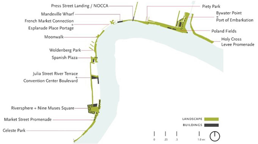
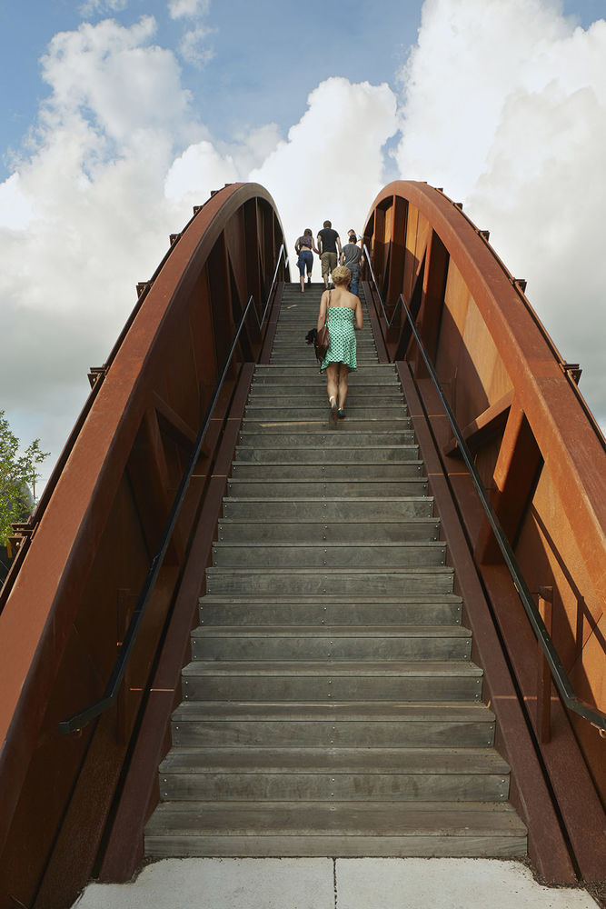
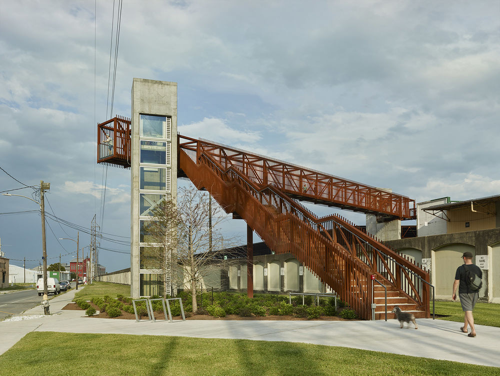
The original riverfront development plan, completed in 2007, proposes a key role for a six-mile stretch along the East Bank of the Mississippi River. From Jackson Avenue upriver to the former Holy Cross school site just down river of the mouth of the Industrial Canal, this plan envisions an urban, active, beautiful river crescent for the city’s citizens to enjoy. The first phase to be implemented from this plan is Crescent Park. It grants unparalleled physical and visual access to the river, creating an environment for locals and visitors to interact and enjoy the essence of New Orleans. A diversity of landscapes coexists within the footprint of the riverfront. Within the master plan development, expansive public parks anchor opposite ends of the project, while smaller, neighborhood-oriented parks are periodically inserted along the project’s length. These parks contain a range of destinations such as wetlands, sun decks, amphitheaters, tennis courts and cafes. Urban plazas are strategically located at major intersections to celebrate the city’s cultural history while also creating energetic new spaces amidst new development. Sustainable streetscapes and paths provide efficient circulation, and a series of pedestrian piers and bridges carry people over flood walls and train tracks to ultimately gaze over the Mississippi River itself.
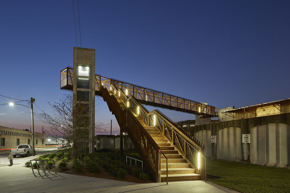
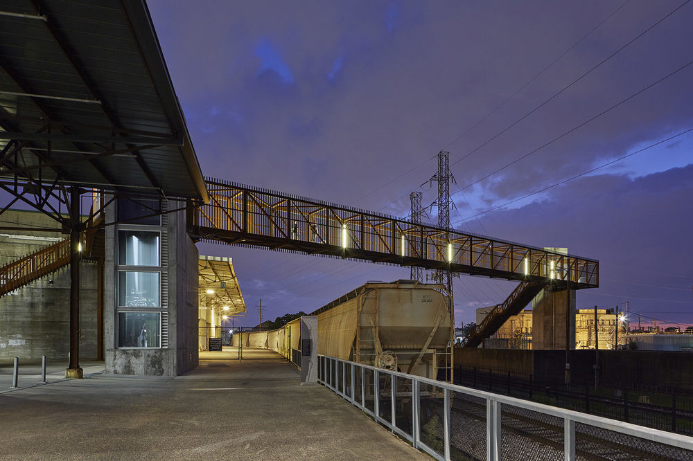
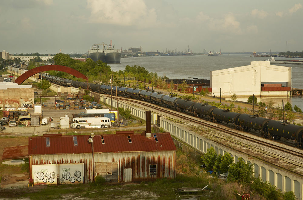
▼一系列架起的步行道和桥梁让人们不再受防洪墙和火车道的阻挡,a series of pedestrian piers and bridges carry people over flood walls and train tracks
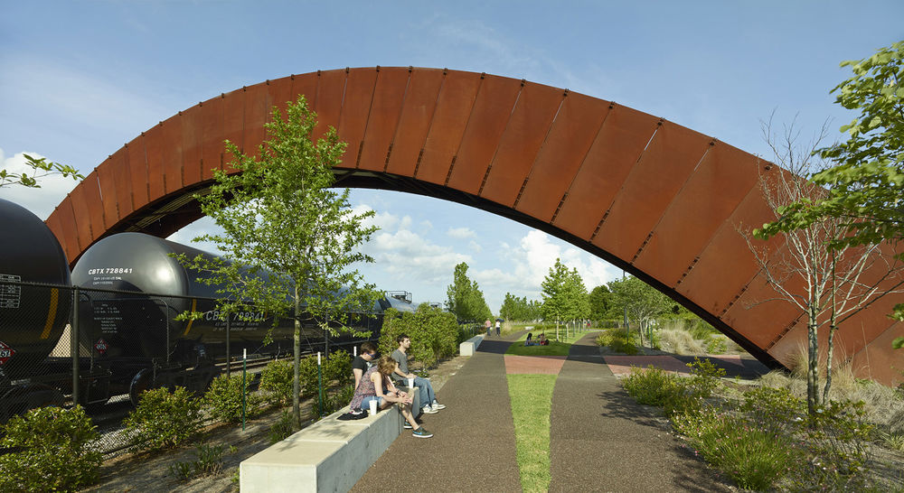
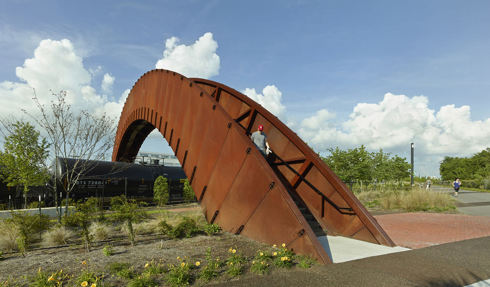
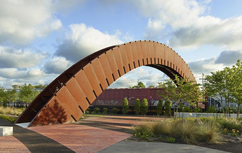
▼桥梁细节图,the detail of bridge
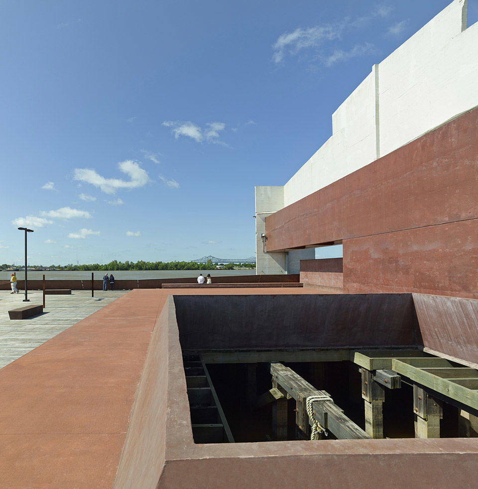
设计团队在整个规划和Crescent公园的设计中从三个不同的层面进行考量。指导委员会和利益集团由个人组成,他们是对该项目感兴趣的人和河滨改造领域的专家。设计团队邀请公众参与超过十二次讨论活动,他们展示设计方案,并从参与者中获取改进意见。设计团队还会接受许多街区和市民的邀请,参加不同的公开会议。在针对最后一次草案的会议中,设计方案得到了全场喝彩。为了确保项目进行的透明性和公开性,整个的实施进度都在网站上公开,此网站还记录了设计优化的过程。Piety Wharf码头位于Crescent公园的中心区域,设计师扩大了它的空间用于居民集会活动,并为他们提供与河边自然景观交流的机会。在两块复原的上升河床之间是街道尽头的一片宽阔空地,在这里可以建造公共设施并为住所较远的市民提供停车场。设计师将箱堤和铁道之间的狭窄区域从五英尺扩大到了三十英尺,沿河而下,营造出一个“货车车厢树篱”线型公园,植被带与相邻火车集装箱的尺度形成和谐呼应,模糊了货运区与河道的关系,同时保留了工业区中继续使用的铁道。植被带的有些区域会被通往河边的道路打断,与道路铺装材料、周边植被和不可穿透的防洪墙形成对比。这个街道的延伸区域为公园的来访者提供了又一个方向的指引。
Throughout the creation of the development plan and the design of Crescent Park, the design team engaged the community at three different levels. The Steering Committee and the Stakeholders Group are comprised of individuals who represent those parties with direct interests and expertise in the redevelopment of the riverfront. The public was invited to more than a dozen forums where the design team presented and received comments. The team also accepted the invitations of many neighborhood groups and citizens to present in various public meetings. Following the public presentation of the final draft, the design received a standing ovation. Ensuring the transparency and accessibility, the entire public process was made available on the project website. This website also served as a history of the design development. Improvements to the existing Piety Wharf, a centerpiece of Crescent Park, expand space for neighborhood gatherings, and offer residents the opportunity to commune with nature at the river’s edge. Nestled between two patches of restored batture, a wider strip of land at the foot of the corresponding street allowed for facilities to be built, and for parking serving residents who live further away. A narrow strip between box levee and rail tracks widens from five feet to thirty feet, moving downriver, allowing for a linear park of “boxcar hedges,” vegetation planted in orthogonal bands matching the scale of the adjacent railroad container cars. Grouping the vegetation bands at boxcar scale blurs the relationship of active freight to the river, while maintaining the industrial scale of the continuing activity of the rail activity. The bands of vegetation are periodically bisected by the figurative extension of the street grid to the river, physically expressed as a contrasting paving material and species, as the flood wall cannot be punctured. This extension of the street grid doubles as way finding for park visitors.
▼Piety Wharf码头,Piety Wharf

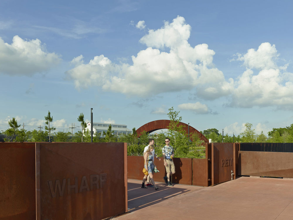
铁路从轨道的弧线中分离出来,到达每个码头,弯曲的铁轨和碎石时隐时现。1200英尺长的花园建立在这些复杂的轨道之上,由轨道组成人行道路的轨迹,构成一系列包含主要自然植物的汇聚花园,可以将人们从主步道上转移,进入小型步道。
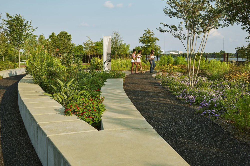
Railroad spurs once peeled off from the main line in tight arcs, with multiple spurs arriving at each wharf. Traces of the spurs remain, with curving bands of ballast and iron rail intermittently visible. The 1,200-foot-long gardens draw on this complex of spurs as the generator for pedestrian paths framing a series of converging garden plots containing primarily native vegetation species. The gardens offer a diversion from the main pedestrian promenade, with smaller paths and opportunities for lingering.
▼铁路从轨道的弧线中分离出来,到达每个码头,railroad spurs once peeled off from the main line in tight arcs, with multiple spurs arriving at each wharf
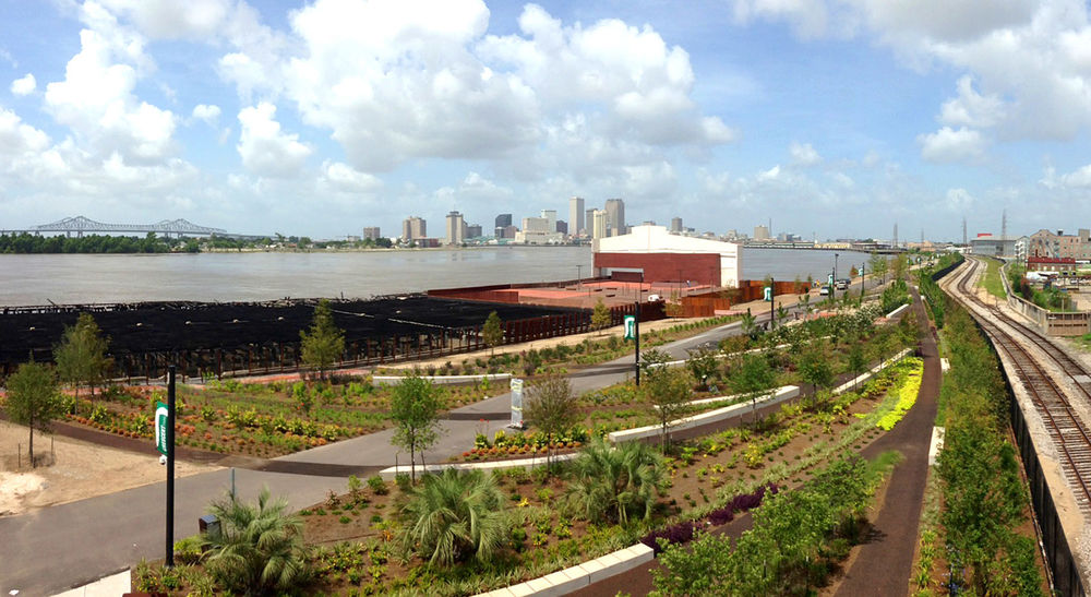
▼步道,pedestrian promenade
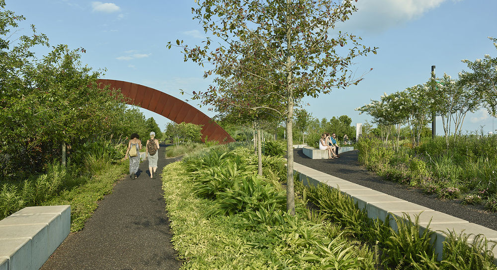
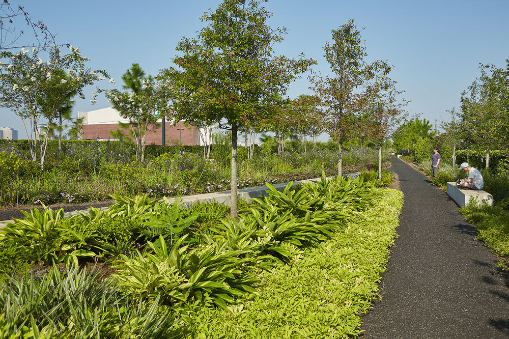
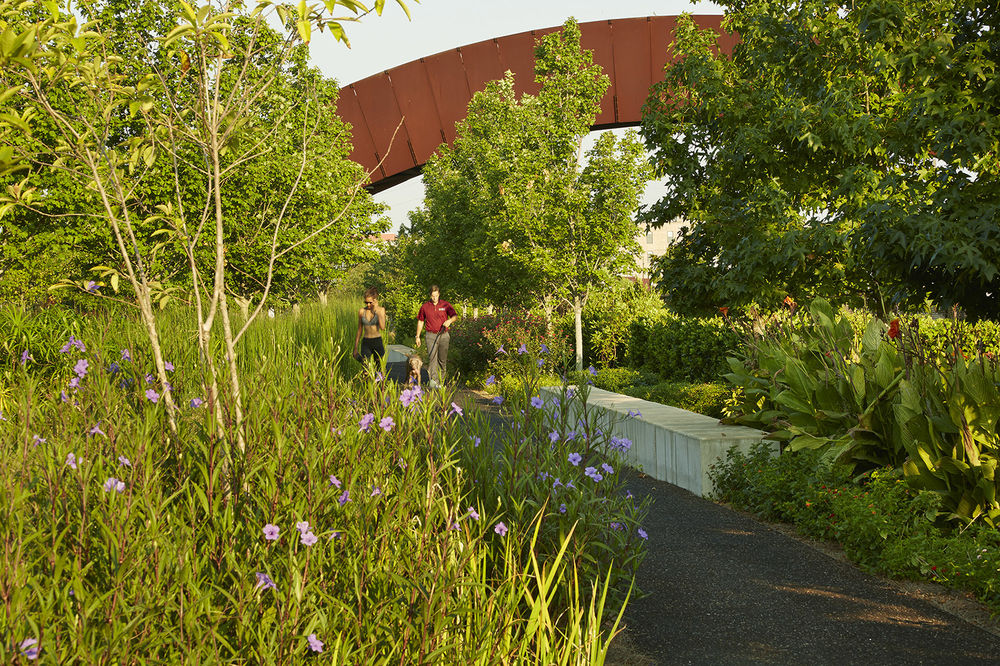
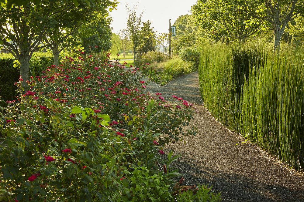
▼步道细节图,the detail of pedestrian promenade
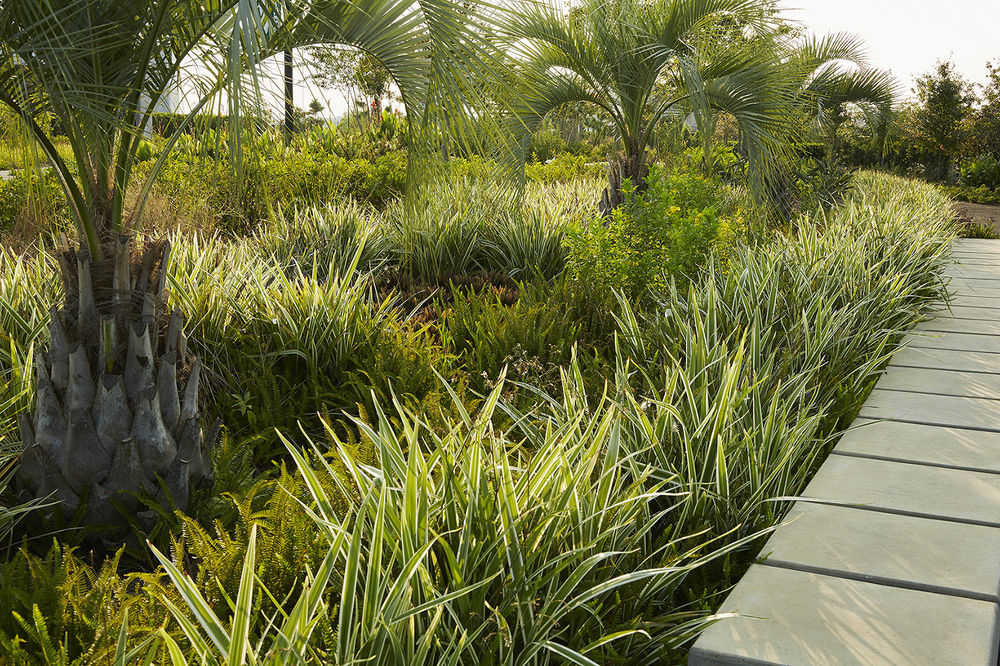

公园的首要作用是为各个空间建立连接:为原本住的很近却不能接近河滨景观的居民提供道路:可以允许交通工具进入,也可以容纳大部分建筑结构。设计团队认为建造河流管控设施是不切实际的且费用高昂,因此他们将注意力集中在了为行人制造粗糙的后工业海事景观上,保留了原来重型商业港口上的铜绿。公园中的天然景观区域面积远胜于人造草坪,设计师保留了在港口废墟结构上不断生长的植被,为景观营造提供了一个更加可持续的方式。
The park is first and foremost about connection: reconnecting neighbors to the river they live so tantalizingly close to, but have long been denied access to this riverfront landscape: free of vehicles, and now, largely free of structures. Given the impracticality and cost of taking on the river control structures, the team focused their efforts on making the coarse, post-industrial maritime landscape accessible to pedestrians without scrubbing away the patina of past heavy commercial port use. Native landscape far outweighs the area given to grass lawn, continuing the ever-increasing growth of vegetation over the decaying port structures and promoting a more sustainable landscape approach.
▼为原本住的很近却不能接近河滨景观的居民提供道路,reconnecting neighbors to the river they live so tantalizingly close to, but have long been denied access to this riverfront landscape

▼架桥夜景,night view of the bridge
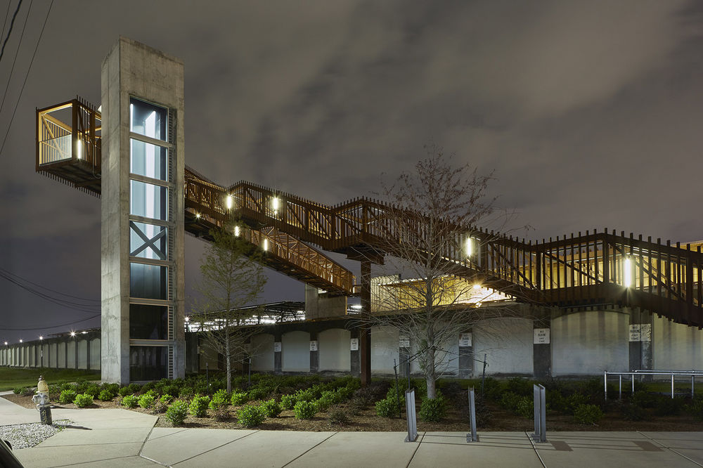
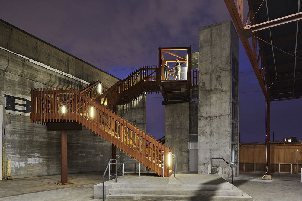
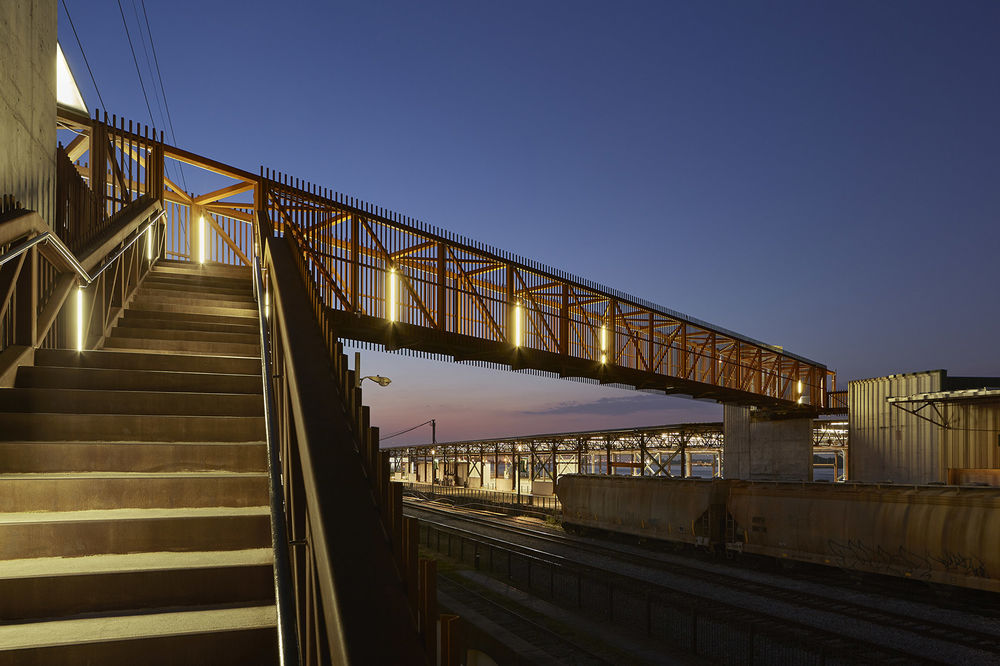
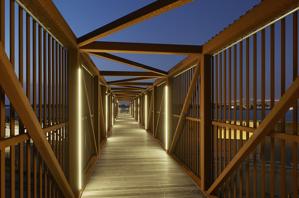
▼粗糙的后工业海事景观,the coarse, post-industrial maritime landscape

▼夜景,night view

Eskew+Dumez+Ripple Team: Mark Ripple, Principal-in-Charge; Amanda Rivera, Project Manager; Allen Eskew, Principal-in-Charge Project Team Core Team: Eskew+Dumez+Ripple, Executive Architect / Architect of Record; Hargreaves Associates, Landscape Architect & Design Lead; Adjaye Associates, Design Architect (Piety Wharf & Bridge); Michael Maltzan Associates, Design Architect (Mandeville Wharf & Bridge) Additional Consultants: Chan Krieger Sieniewicz, Urban Design; Kulkarni Consultants, Structural Engineering; Lucien T. Vivien Jr. & Associates, MEP Engineering; St. Martin Brown & Associates, Associate Architect; Johanna Leibe & Associates, Associate Landscape Architect; Lam Partners PHA Lighting Design, Lighting Design; Urban Systems, Traffic Engineering; C.P. O’Halloran Associates Inc., Cost Estimating Photographer: Timothy Hursley
