遂宁南滨江公园 | 城市与自然的共生纽带
易兰规划设计院:四川省遂宁市,位于四川盆地中部腹心,涪江中游,是成渝经济区的区域性中心城市,具有观音之乡的美誉,文化底蕴深厚,有良好的滨水景观资源。遂宁是一座生态花园城市,拥有优越的自然禀赋,市域范围内坐落着湿地生态公园、国家地质公园、文化古镇。遂宁地处成渝经济圈的腹心,人口、经济和产业不断发展,对四川发展起到引领和带动作用。市政府希望通过滨江南路景观带的打造,为遂宁增加一个美丽的城市名片,为市民增加一处喜闻乐见的滨水休闲场所。
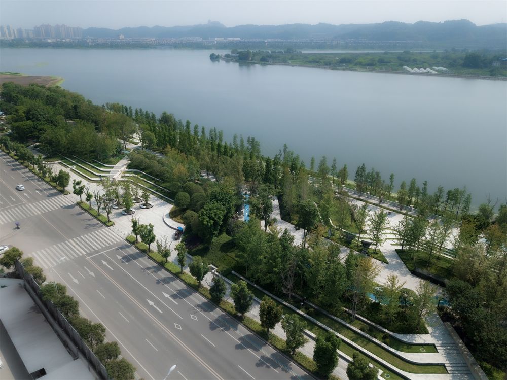
ECOLAND: This project transformed a 2-mile long ecologically and socially lifeless shoreline belt into a verdant, sustainable riverfront park by integrating ecological infrastructure, phytoremediation, urban-weaving and resilient strategies. A much closer water to human relationship is introduced by concealing an existing bulkhead structure beneath stylized terraces of landscape inspired by Asian culture, drawing city dwellers and urban visitors towards the forgotten natural beauty of the Fujiang River. The gray hydraulic dam in the outer edge of the city is transformed into a desirable riverfront destination.
易兰的方案根据不同人群的活动需求,为市民提供了一个高参与性的滨江绿带公园。项目重建了城市与河流之间联系,同时创造了一个充满活力和生命力的公共服务空间。完成后的滨江公园已成为联系城市的纽带,对接整个城市的绿色廊道和活动空间。
▼区位和平面图 Location and plan
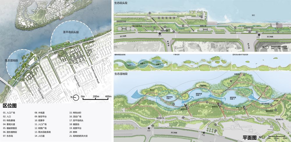
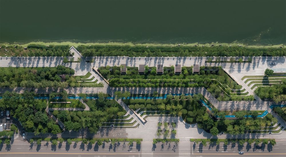
©Holi 河狸景观摄影
©Holi 河狸景观摄影
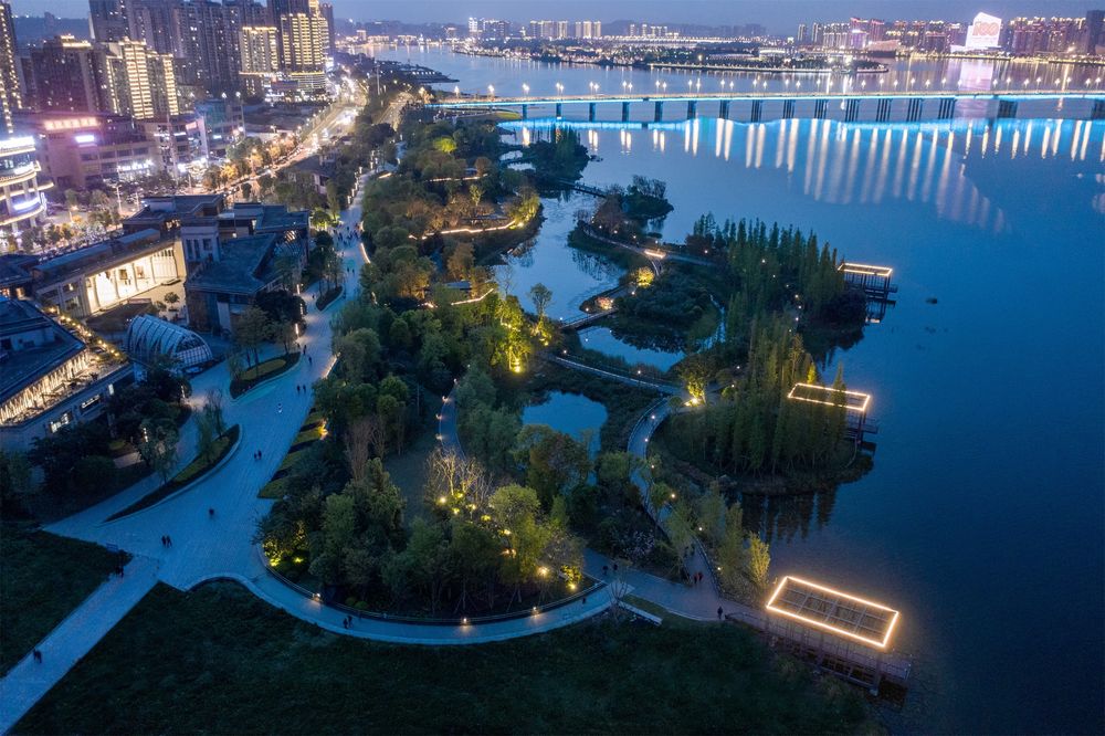
▼湿地夜景鸟瞰 Night view of wetland
©Moooy 目外摄影
弹性策略与生态工程战略 Resilient Strategy & Ecological Engineering Strategy
该项目最初是被一条宽阔的滨江道路与相邻社区隔离开来的场地,而该场地几乎不被该城市的人们所用,只是城市防洪建设。设计团队说服水利工程团队采用不同的方法来重新组织河流与人的关系,与普通的将河流与绿地,人与城市分隔开来的工程防洪方法形成鲜明对比。
Before the landscape architects were commissioned to design the 117-acre park in mid-2017, the local government had been installing riverfront hydraulic engineering structures covering two-thirds of the length of the riverbank in an unappealing concrete bulkhead that was an eye-sore to the community. Being that the structure was required to remain in the park to prevent flooding, it was imperative for the design team to find creative solutions for dealing with this major obstacle between the city and the river. Repairing the ecological degradation to the river caused by the construction of the bulkhead was also paramount.
▼改造前后对比 Comparison before and after reconstruction
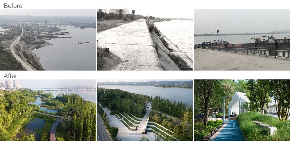
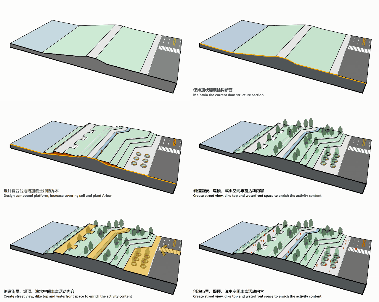
场地原有大堤紧贴滨水岸线,生硬呆板、类型单一;城市界面缺乏休憩停留空间,缺少与滨水空间联系。为了恢复河滨活力并创建可行的休闲绿地,而不是在不与城市进行任何对话的情况下创建独立的绿化带,设计团队制定了复杂的城市组织策略以整合城市公共空间。
The combined design team consultants successfully persuaded the local government to integrate the ongoing hydraulic engineering construction with the forthcoming park design project. Through a concept of concealing the bulkhead beneath landscape terraces, the design objective is set up to combine multiple functions, including riparian ecological systems, urban storm-water management, green infrastructure, public recreation, and environmental education in the same riverfront area. The ultimate solution became the “Floating Greenway” infrastructure belt. The “Floating Greenway” infrastructure artfully integrates all the desired functions by weaving together a series of design strategies.
©Holi 河狸景观摄影
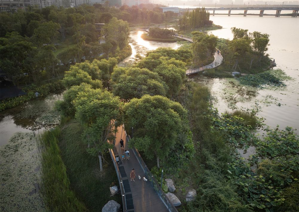
在生态湿地段设置了一个复杂的河岸湿地泻湖系统,采取了一种生物工程技术来掩盖现有的液压基础设施。单一的硬混凝土河岸由再生生态系统和综合娱乐系统覆盖,将安全、生态、美丽和城市娱乐无缝地结合在一起。
全新滨河景观 The new riverfront landscape

©Holi 河狸景观摄影

©Moooy 目外摄影
The recreation walkway belt, above the stormwater filtrating wetland, links the scattered barrier islands bringing people closer to the refreshing natural scenery. The Elevated Canopy Walks allow visitors to have an above-the-wetland and in-the-canopy experience, enveloping them in picturesque nature.
Cut from the excavated ponds is used as fill to create a barrier of islands acting as a landscape buffer, transition zone, and a vibrant storm water filtrating system connecting the river and the city.
2.生态湿地水体净化 Ecological wetland water purification
该段湿地现状有 1100 米栈道,且因防洪需求不能放置过多构筑物。方案重新梳理现状,在保留原有湿地浮岛结构、原有 650 米栈道基础的前提下,增加栈道平台、眺望亭综合整治激活场地。
▼水体净化策略 Water purification strategy
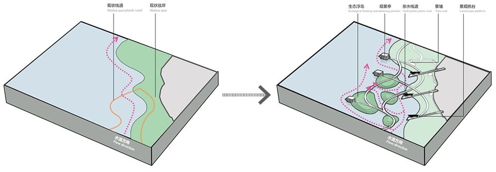
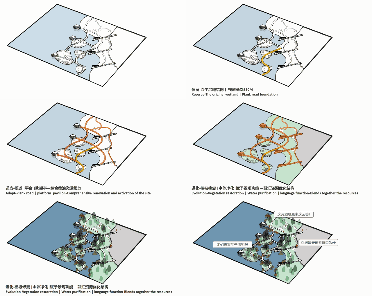
植物修复 Phytoremediation
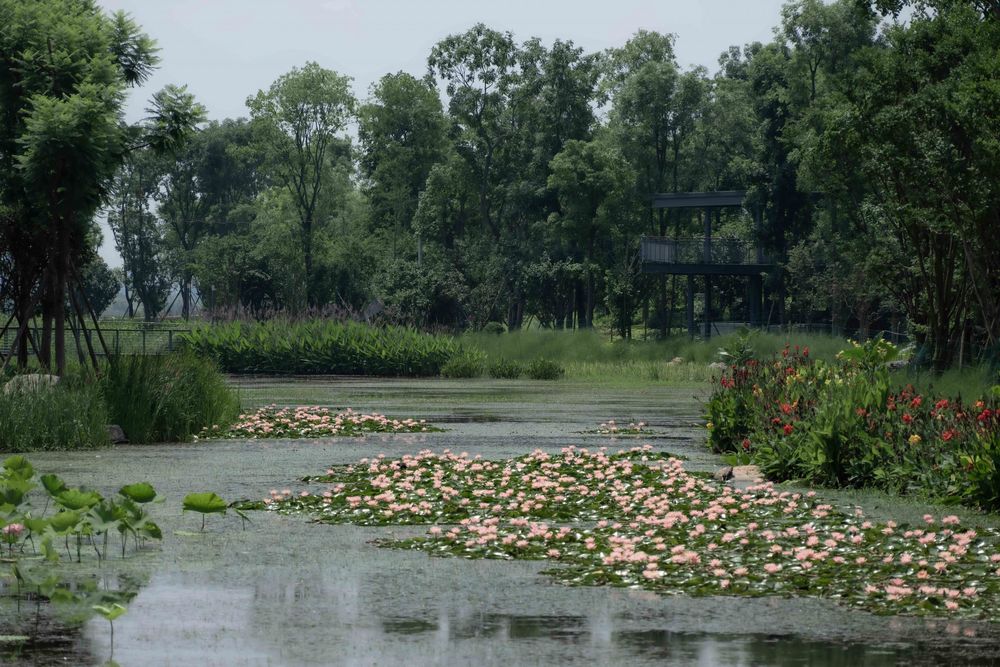
通过将本土湿地植物引入到河流上游较宽流域的河滨湿地泻湖中,形成了水生植物修复系统,一方面通过河岸种植创造出一个绿色缓冲带,减轻河流对河岸的侵蚀,另一方面将已经处理过的城市径流再次净化,排入涪江。在湿地、池塘、岛屿的错综复杂的生态系统中重建了本土物种,并为野生动物提供良好的栖息地。
By introducing native wetland plants into a series of riverside wetland lagoons at the wider, upper flow area of the river, a water phytoremediation system was formed. It is entirely constructed of nature, created to clean the already treated urban run-off before it is discharged into the Fujiang River. A minimal cut-and-fill approach was used to create an outer ring of islands and ponds. Cut from the excavated ponds is used as fill to create a barrier of islands acting as a landscape buffer, transition zone, and a vibrant storm water filtrating system connecting the river and the city. Water flows through the wetland lagoons to be filtered by the plants before being used to encompass various park destinations with ecologically sound water features for people to enjoy.
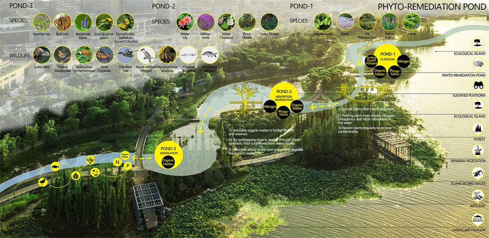
▼湿地俯瞰 Wetland overlooking
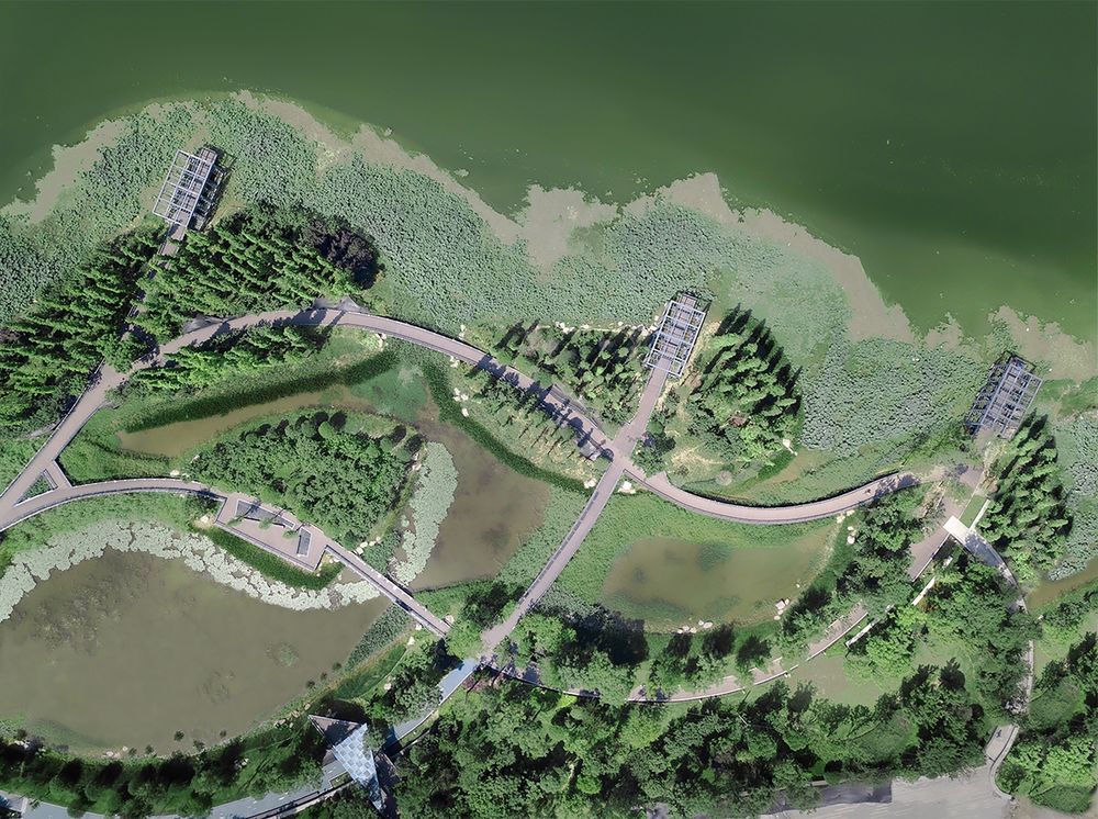
©Holi 河狸景观摄影
利用了原有的低洼坑塘,调蓄水位,保留原生湿地结构,以最少的人为干预,实现低成本的修复模式。疏通坑塘水系,增强河流景观的蓄洪调水功能。形成水生植物茂密,鱼鸟尽欢的湿地公园。
The re-establishment of native species within an intricate system of wetlands, ponds, islands and riparian habitats in a previously barren terrain contributed to an overall reacclimatizing of the riverfront that welcomes the return of native wildlife, cementing this project as a pilot for resilient green shores infrastructure initiatives.
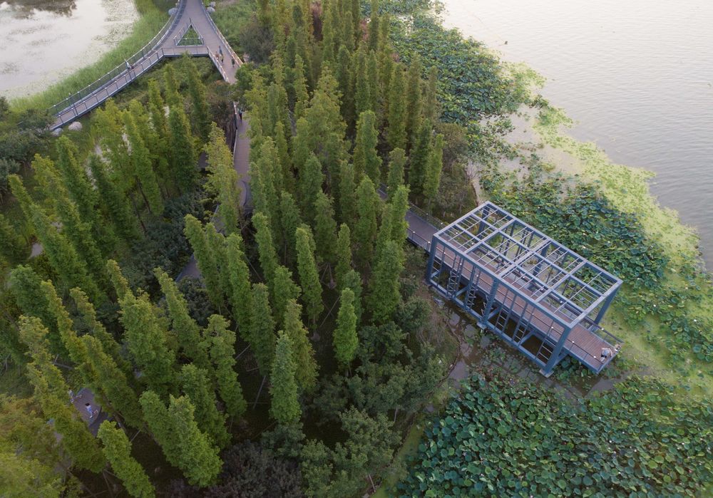
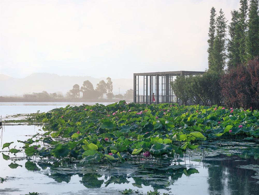
Wetlands metasequoia forest and coastal aquatic plants
©Holi 河狸景观摄影
©Holi 河狸景观摄影
▼掩映在丛林中的眺望亭 A viewing pavilion nestled in the jungle
©Holi 河狸景观摄影
©Holi 河狸景观摄影
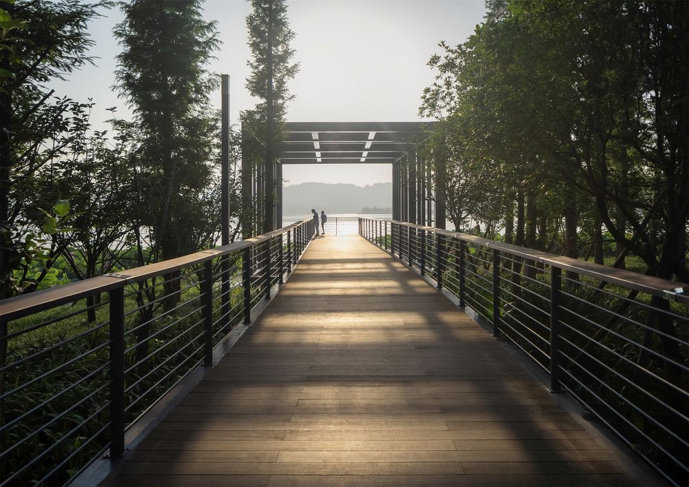
休闲设施根据不同水位的涨落情况进行合理布局。利用架空栈道及廊架休闲设施,为人们提供丰富有趣的自然体验,成为人们放飞自我、接触自然的好去处。
A “floating pavilion”, with cypress trees buffering the northwest wind, creates a pleasant destination space for meditation or river overlook view points, allowing people to experience the feeling of being immersed in nature.
▼弹性河岸湿地泻湖系统 Elastic riparian wetland lagoon system

©Holi 河狸景观摄影
▼林中的架空栈道 An elevated walkway in the woods
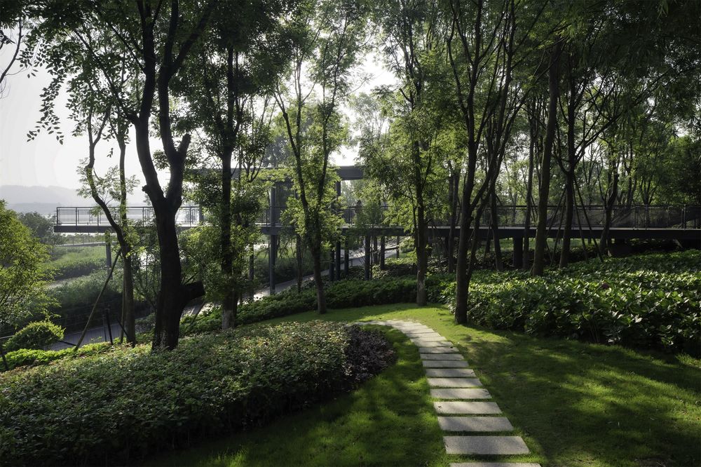
©Holi 河狸景观摄影
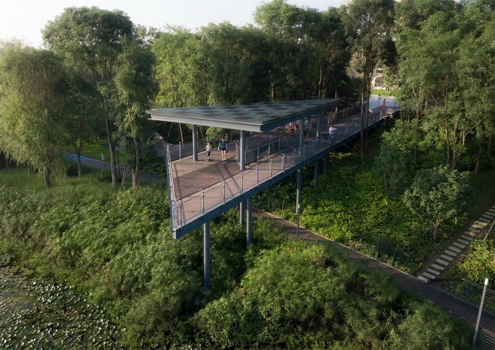
©Holi 河狸景观摄影
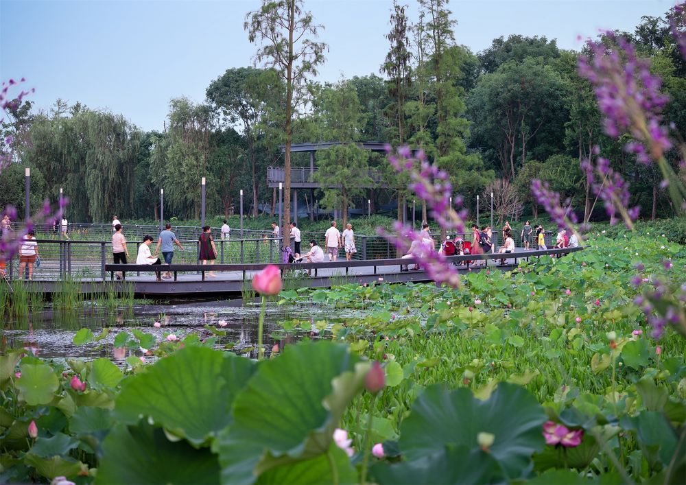
方案保留和利用坑塘中原有廊道及拆迁构筑物的基础,修建湿地游憩栈道和观景廊架,为市民提供怡人的亲水休闲体验。此外,方案十分关注栈道系统与周边地块的联系,将周边商务区与居民区的步行道延伸到湿地栈道系统中,形成该片区的环状慢行网络,并与公交站点以及水上交通节点轮渡口接驳。
▼市民在此休闲娱乐、亲近自然 Citizens enjoy leisure and nature here
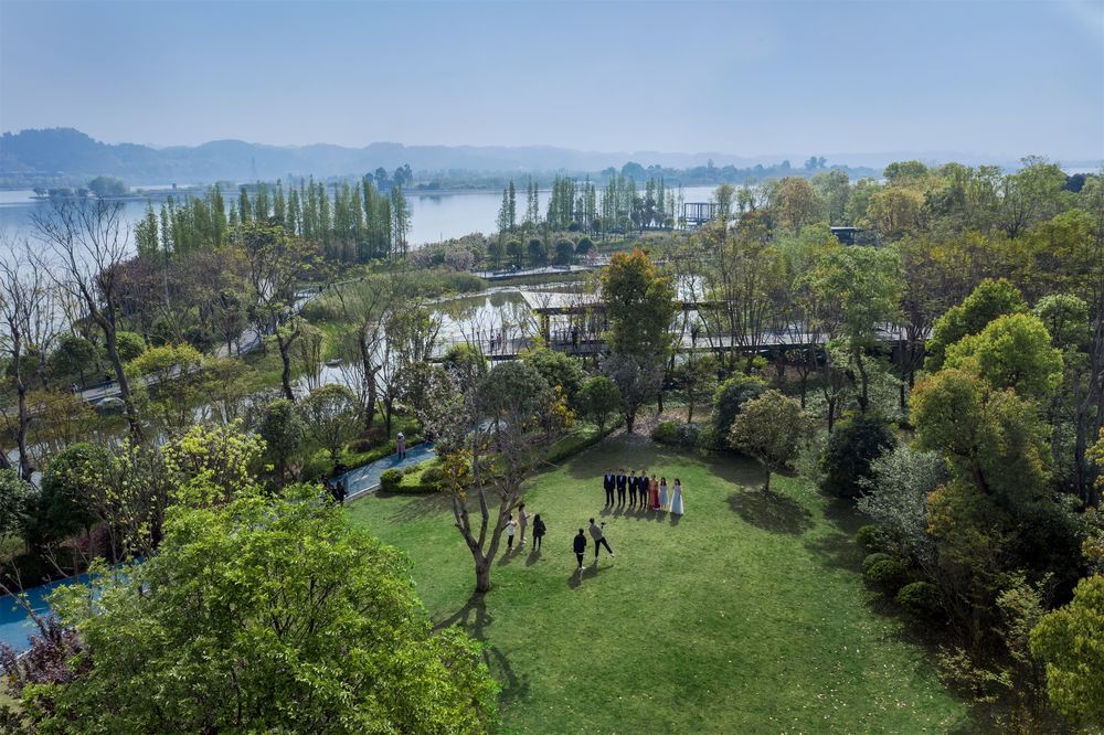
©Moooy 目外摄影
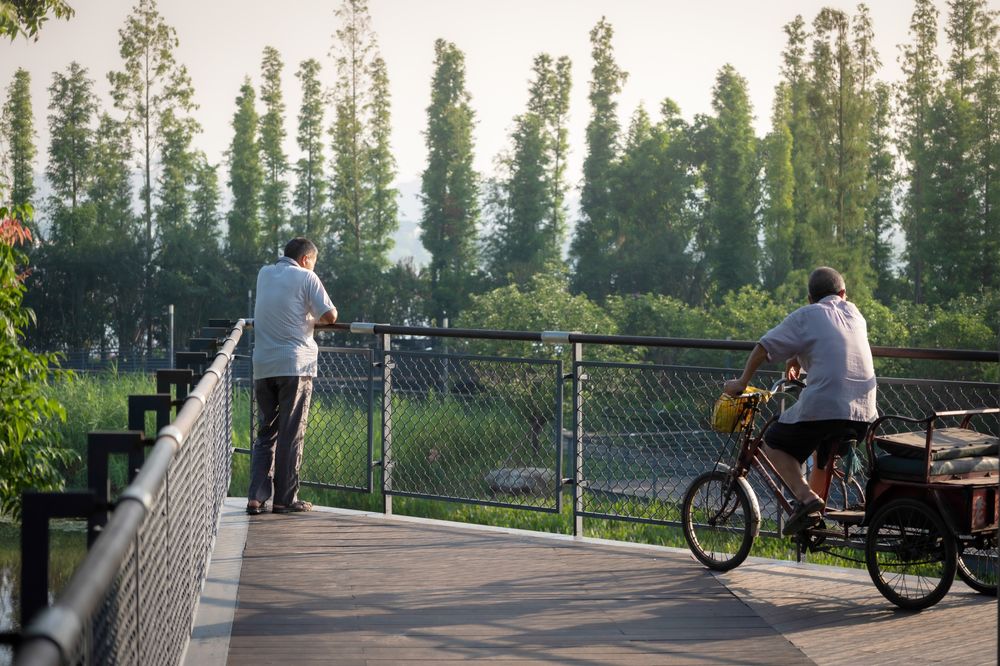
©Holi 河狸景观摄影
3.城市组织 Urban Weaving
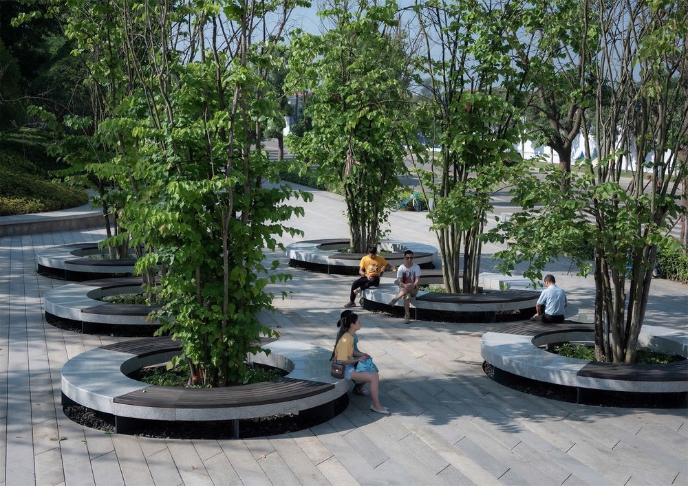
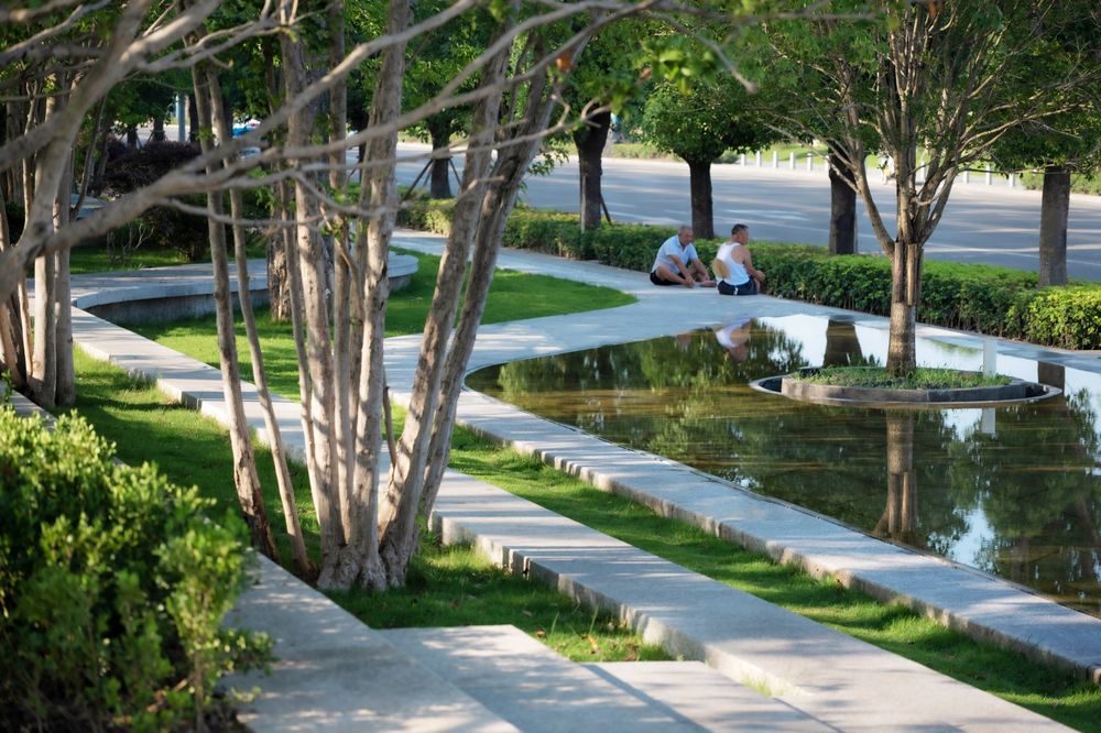
方案对原有的大树予以保留并围绕它们进行设计,或利用座椅环绕大树形成别具风情的林下休闲点,或将时尚新颖的廊架穿插掩映于树冠之间,相得益彰。
▼结构分析 Structure analysis
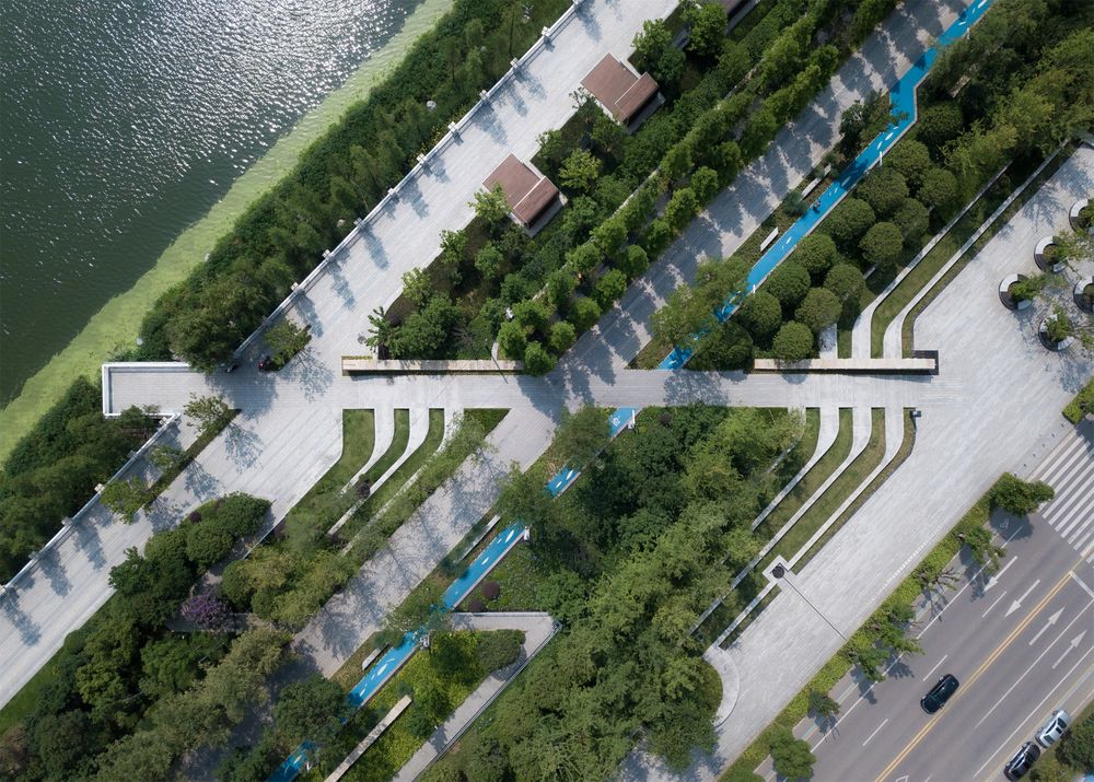
绿色慢行网络 Green slow network
©Holi 河狸景观摄影
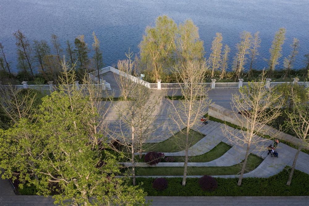
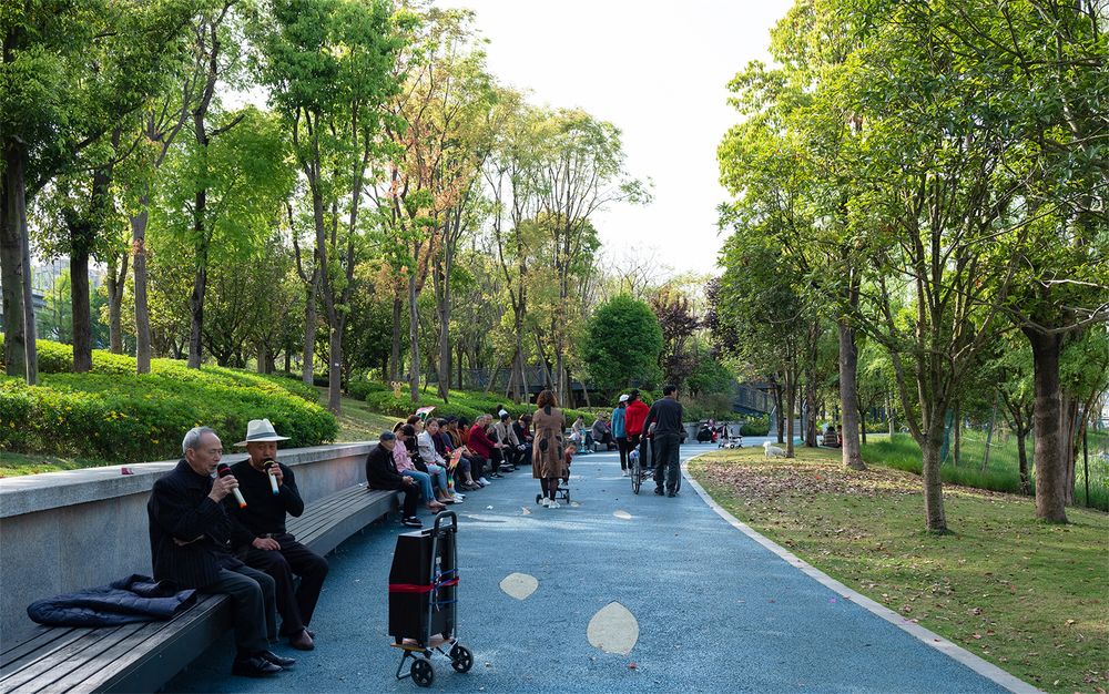
在尊重原有河岸及河堤路的基础上,增加了贯穿整个河岸线的慢行系统、健身步道及配套休闲设施。着重打造了滨水休闲界面和滨江路城市景观界面。在与涪江相接的滨水界面上设置了码头、滨水广场,挑出水面的观景台、休闲廊架以及适合各个年龄段的市民休闲活动设施。与城市相连接的城市界面,则通过小型开放广场、台地地形塑造、汽车停靠站以及沿街绿化等的重新梳理,打造清新怡人的街景空间将城市环境与滨水公园无缝连接,把市民自然地引入公园环境中,为市民提供了一个高参与性的滨江绿带公园。
Originally cut off from the adjacent community by a broad riverside city road, the project’s site was almost abandoned by the city’s inhabitants. To restore the riverfront and create a viable recreational green space, a complicated urban weaving strategy was established to integrate the urban public space rather than create an independent green belt without any dialogue with the city.
▼树池座椅 Tree pool seat
©Holi 河狸景观摄影
滨江挑台 Binjiang pick machine
©Moooy 目外摄影
▼健身步道 Fitness trails
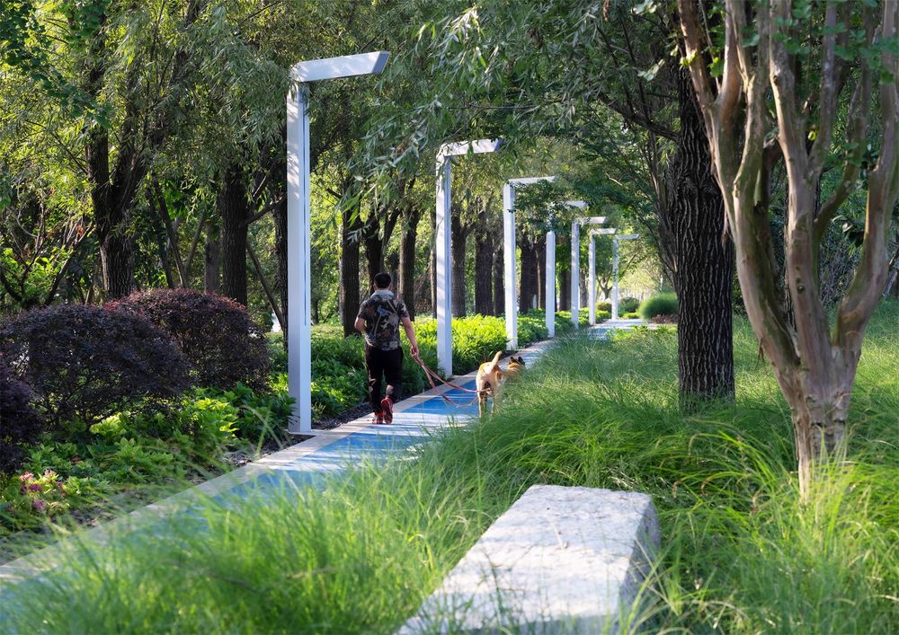
©Holi 河狸景观摄影
▼改造后的堤岸 The renovated embankment
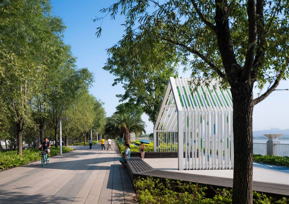
©Holi 河狸景观摄影
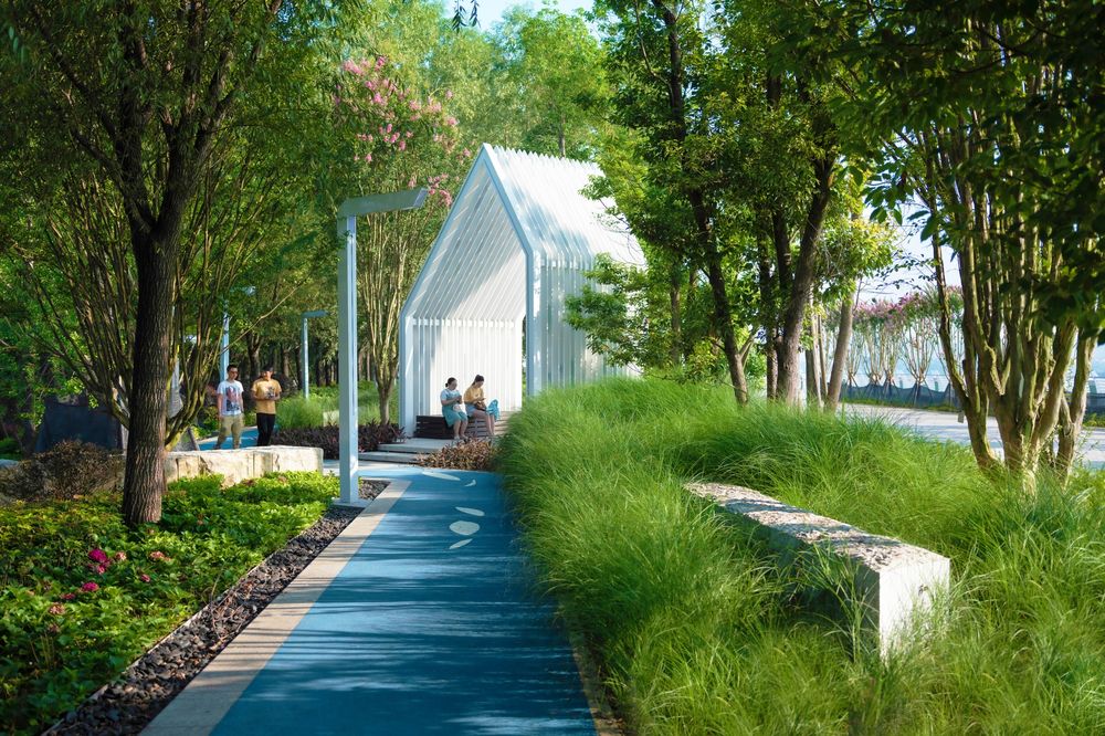
©Holi 河狸景观摄影
The generous pedestrian walk, integrated with a series of open spaces, creates an elegant grand terrace embracing the expansive view of Fujiang River, Shengping Island, and the East Mountain, making it one of the most-visited destinations in the park.
▼林下休憩空间 Forest rest space
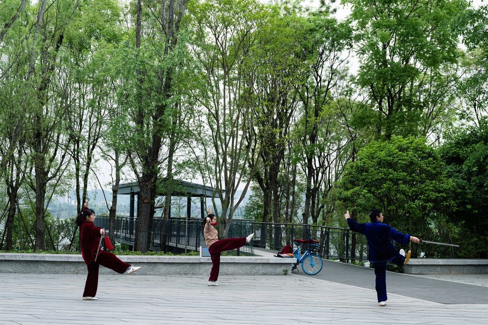
©Moooy 目外摄影
©Holi 河狸景观摄影
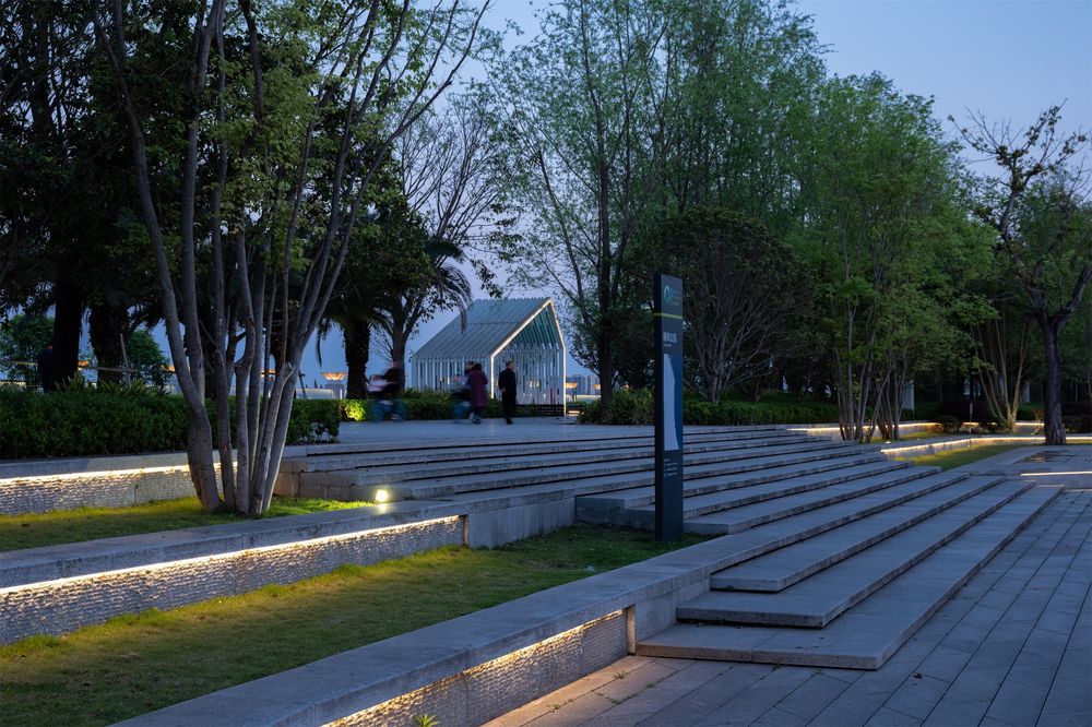
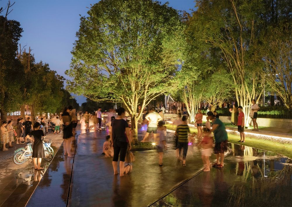
A “floating reflection river” is created along the urban portion of the riverfront park, bringing the river back to the people. Integrated lighting design illuminates the riverfront park, rendering a warm atmosphere, filling the nightlife with vigor and romance.
▼灯光设计与夜生活 Lighting design and nightlife
©Moooy 目外摄影
©Holi 河狸景观摄影
方案关注项目在整个城市片区中的定位及其功能联系,将滨江公园打造成整个城市慢行网络的核心区域,重点处理其与周边路口的街道接驳点,使其成为多个慢行圈的交叉点。
The key objective to the urban weaving strategy was to collect and distribute people seamlessly through the park to enjoy the verdant river views and pleasing riparian open spaces, connecting the riverfront back to the city.
4.雨水管理 Stormwater Management
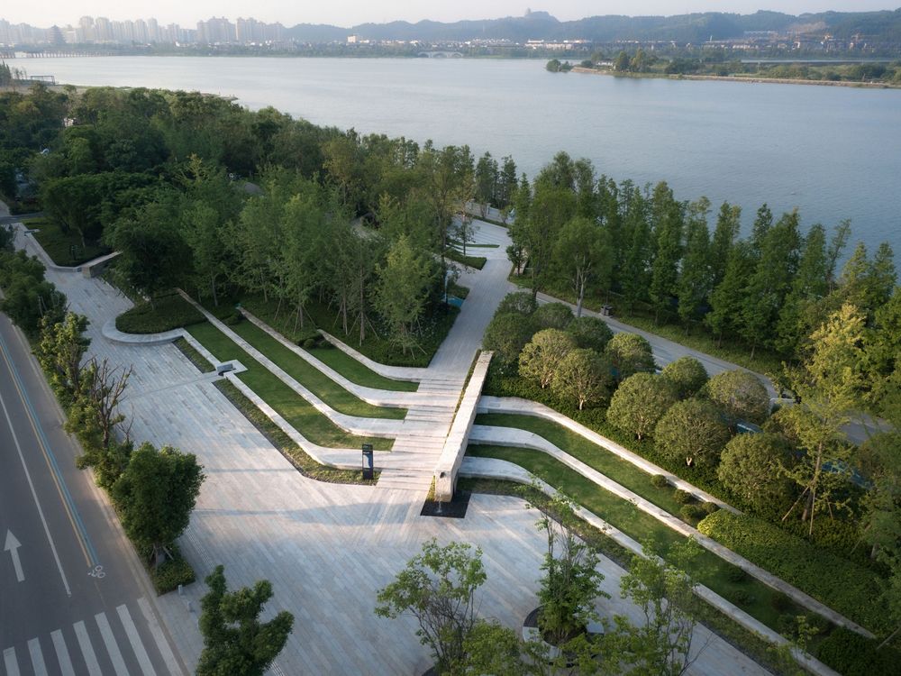
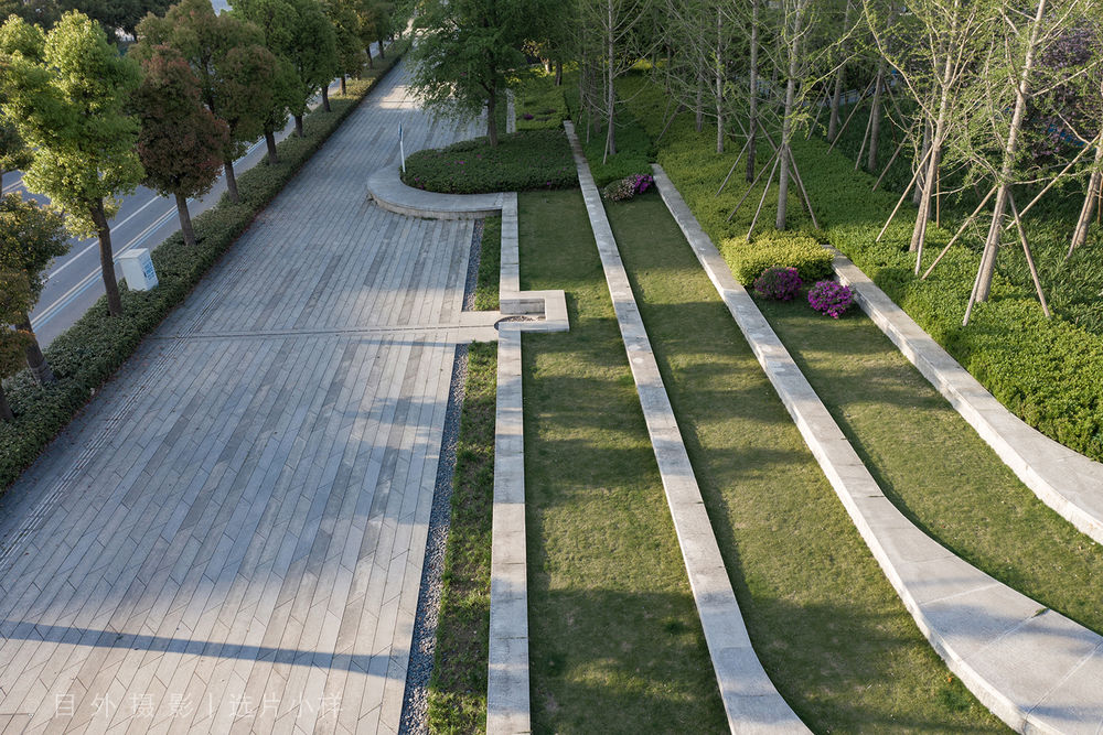
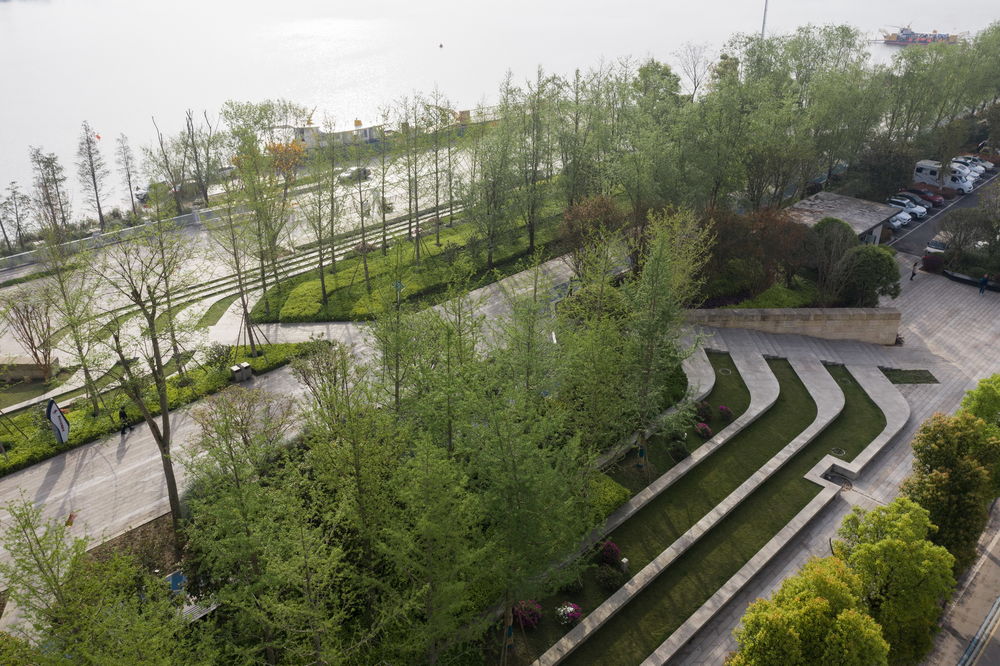
这个设计把整个步行街组织成为一个雨水管理的展示花园,收集和利用降水径流,把自然生态的理念与精致的设计细节有机结合为一体。方案尽量保留场地上原有的树木和可利用的铺装,减少浪费,摒弃高投入的建造模式。秉持低影响开发的理念,在沿城市界面的河堤反坡上,因势利导地利用原有地形塑造富于观赏性的台地花园。梯台景观与路径上的台阶精致地组合一体令人耳目一新。
▼雨水收集与利用 Rainwatercollectionandutilization
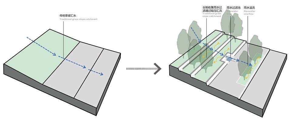
在防洪堤上建立的公园部分比街道高出 2 米。为了在防洪堤的两侧收集、过滤和保留地表径流,设计了一系列精巧的雨水管理系统。创建的梯田绿色景观,用以捕获和过滤从公园顶部的人行道收集的径流,过滤后的水由梯田引导至较低的滞留系统,释放到灌溉系统和景观用水设施中,沿途利用叠落水口造景并通过在人行道铺装上设计精巧的细沟,把过剩的雨水导流进街边绿化带中。
A series of richly planted bio-swales was created for the purposes of catching, filtering, and retaining urban runoff water on each side of the bulkhead to release cleaned water to the irrigation system and landscape water amenities. A terraced green landscape creates a resilient feature to catch and filter the run-off collected from the pedestrian pathways at the top of the park’s topography. The filtered water is conducted by the terraces to a lower detaining, and retaining system.
▼城市段 – 雨水台地系统 Urban segment – Rainwater terrace system
©Holi 河狸景观摄影
©Moooy 目外摄影
©Moooy 目外摄影结语 conclusion 项目一期落地,展现出设计团队用现代手法演绎自然环境与人文传统的理念追求,实现了政府和市民所期望的“城市客厅、游憩中心、生态腹地”的环境目标,为遂宁的市民提供了一处理想的休闲去处。
Facing the challenge of ecological degradation and loss of urban vitality due to nationwide government-led flood-control-oriented hydraulic engineering riverfront dam construction, this park establishes a model for integrating civic park design into urban flood protection. Along the edge of Fujiang River in southern Suining City of China, where once an unsightly concrete bulkhead met the water, emerges a carefully regenerated biodiversity park within a living shoreline.
©Holi 河狸景观摄影
©Moooy 目外摄影
项目名称:遂宁南滨江公园
完成年份:2020 年
项目面积:130 万平方米
项目地点:四川省遂宁市
景观设计:易兰规划设计院 ECOLAND & 四川省建筑设计研究院有限公司
主创设计师:陈跃中、莫晓
设计团队:田维民、李硕、张金玲、陈廷千
客户/开发商:遂宁经济技术开发区管理委员会
合作方:施工单位:中冶交通建设集团有限公司 & 重庆渝西园林集团有限公司
摄影师:Holi 河狸摄影 & 目外摄影
Project name: Suining South Riverfront Park
Year completed: 2020
Project area: 1.3 million square meters
Location: Suining city, Sichuan Province
Landscape design: ECOLAND & Sichuan Architectural Design and Research Institute Co., LTD
Chief designer: Chen Yue-zhong, Mo Xiao
Design team: Tian Weimin, Li Shuo, Zhang Jinling, Chen Tingqian
Client/developer: Management Committee of Suining Economic and Technological Development Zone
Partner
Construction unit: MCC Transportation Construction Group Co., LTD & Chongqing Yuxi Landscape Group Co., LTD
Photographer: Holi Landscape photography & Moooy
"增加城市与公园的连接,打造理想的生态环境,市民喜闻乐见的美丽城市新名片。"
审稿编辑 任廷会 – Ashley Jen

