圣安东尼奥菲尔·哈德伯格公园 | 城市生态实验室的绿色创新
“景观设计师在公园的形式化和浪漫气质间穿针引线,并将二者同时纳入到设计中来,创造了一个属于每一个人的场所。”
——2015年评审委员会
“The landscape architect bridges the formal and romantic parts of the park and embraces both. There is a place for everyone.”
– 2015 Awards Jury
项目陈述 PROJECT STATEMENT
Hardberger公园的设计理念是呈现经过培植的野生状态。在过去的7年里,公园逐渐成为圣安东尼奥丰富的文化底蕴的集中体现,并将多样的、具有迅速复原能力的本土生态融合进来。占地311英亩的公园将75%的用地用于本土景观的保护和修复,剩下的25%顺应自然,植入对景观影响甚微的娱乐系统。最先进的绿色基础设施和修复过的多样化景观,让公园成为德克萨斯州南部关于城市生态、健康生活和可持续发展的生机勃勃的实验室。
The concept for Hardberger Park is cultivated wild. Over the last seven years, this Park has become an integration of the rich cultural history of San Antonio, blended with the diverse and resilient ecologies that are native to the region. The Park dedicates 75% of the 311 acre site to preservation and restoration of this native landscape while seamlessly embedding 25% as low-impact recreation. Engaging state-of-the-art green infrastructure and a restored, diverse landscape, the Park has become a living laboratory for urban ecology, healthy living, and sustainability in south Texas.
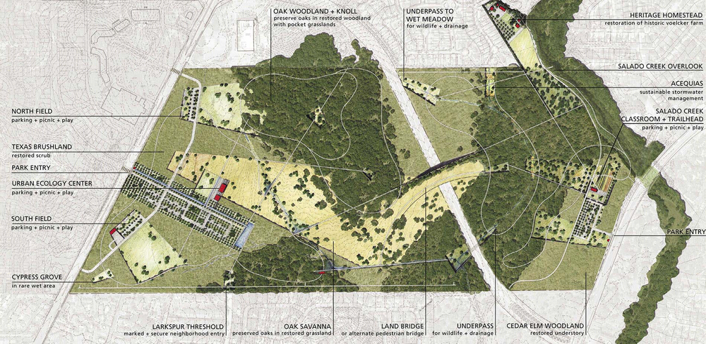
△ 总体规划,Site Master Plan
Photo Credit: Stephen Stimson Associates
项目说明
区位和背景
2007年,德克萨斯州圣安东尼奥市市长Phil Hardberger及市政公园和文体活动部发起了一场国际设计竞赛,对城市北部新近获得的一块土地进行规划设计。作为竞赛的获胜者,设计团队负责为这座美国第7大城市提供一个符合21世纪标准的公园总体规划与设计。这块面积达311英亩的土地是圣安东尼奥最大的一块未开发用地,也是自1899年以来,城市最重要的公园项目。位于主要人口聚集区的核心位置,公园在人均公园占有率低于全国平均水平的城市环境中为市民提供迫切需要的开放空间。
公园用地位于3个生态区——南德克萨斯州平原、黑土草原以及爱德华兹高原的交汇处,从遗留下来的橡树林到濒危的橡树草原,独特的地理位置为景观修复提供了丰富的图景组合。作为曾经的奶牛场,这一区域还存有放牧和耕作等农业活动的痕迹,是圣安东尼奥先民独特的历史印记。Hardberger公园是圣安东尼奥第一个进行总体规划的公园,引发了强烈的社会关注。从一开始,设计团队除了负责对这座城市规模的公园进行规划设计的同时,也在城市的6个区投入到前所未有的社区会议和公众研讨中去。这种公众参与的制度也贯穿到接下来的设计阶段中:设计团队向公众展示设计提案,公园理事会和历史街区委员会负责审核批示。
以呈现“经过培植的野生状态”为目标的Hardberger公园,其概念框架是让75%的公园用地呈现复兴的复合式本土景观,包括保护遗留下来的老橡树、修复林地和灌木以及引入濒危的橡树草原——广阔的原生草原才是真正的德克萨斯州野生生态的精魂。剩余25%用地用作公民聚会及娱乐活动的场所,谨慎地植入到原生和修复后的景观中去。这些区域的设计灵感来自城市的文化景观,是对先民放牧和耕作情境的再现。设计的结果是打造出一座尊重自然环境,并在人工和自然元素间建立起动态联系的公园。
一条6车道的机动车道将公园平分成2个地块。东侧以萨拉多河为界,通过河边绿道与地区公园系统相连,拥有一片低地硬叶榆木林,间或分散着片片橡木丛。西侧是一大片繁茂的包含各种入侵物种的灌木丛、一座高起的橡树林丘地和暴露在外的石灰岩。其他方位则为紧密的社区和开发用地所环绕。道路下方的排水渠提供了一条野生生物廊道,将两个地块连系在一起。最终,一座纪念性的陆桥将再度连接这两个地块。在设计的开始阶段,仍有一小部分用地用于放牧,大部分的区域由密实至不可穿越的灌木丛覆盖。这些繁茂的下层植被几乎取代了原生草原,遏制了残留的橡木丛和硬叶榆木林的生长。因此,保护遗留下来的林地、管理灌木丛、修复原生橡树草原成为首要的设计目标。同时面面俱到的修复工作还包括在两个地块内各开辟一处可停放350辆车的停车场、野炊园地、游乐场地和遛狗园区。
东侧,莎拉多河户外课堂和步道口(Salado Creek Classroom and Trailhead)是一处面积为2400平方英尺的公园服务设施,配备卫生间、办公室、户外教室和讲解大厅,整座建筑由太阳能电板供电并装有雨水收集系统。此处是公园的总部也是莎拉多河绿道的门户。沿着绿道走廊向北是莎拉多河观景台,由耐候钢和铝材搭建而成的60英尺长的构筑物,悬挑在河床上方40英尺处。数年来,城市对这些临时性的水道视而不见,进行粗暴地掩埋或当做下水道使用。溪流的这一段经过自然化,沿着陡岸形成了独特的喀斯特地貌,通过观景台可观看得到,那里设有解说牌讲述公园地貌变迁的历史。西侧,一片5英亩的游乐区从灌木丛中小心翼翼地开辟出来,用于静态娱乐项目和公共艺术展示。该区域种有耐旱的原生牛毛草,最近Tom Otterness的雕塑装置Making Hay正在这里展出。总体规划将西侧60英亩的区域用于橡树草原的恢复,这一项目的实施需要很长时间。公园和文体活动部有选择地清理出一块6英亩的实验田,全市的自愿者在此栽种了4万余棵原生树种。
长度超过6英里的小路主要由当地风化的花岗岩碎石通过有机固定剂铺装而成,经过仔细编排散布在林地各处,同时将两个地块中全新规划出来的空间连通起来。木板路建造在横穿水道的区域,整个道路系统尊重现有遗留的橡树、柿子树和硬叶榆木的生长需要,在“路遇上树”的地方保护好区域内的生态环境。景观设计师设计了一套综合性的标识,包括两个主入口标志、环路标志、指路标志和讲解标识。使用的材料,如Leuders石灰岩、喷砂混凝土、生钢、雪松板以及回收来的钻头杆件,在当地寻常可见,既显示出对圣安东尼奥原生景观的尊重,又将该项目与地区背景结合起来。
公园的西面建造了一座面积为18,600平方英尺的城市生态中心,为社区提供了休闲、教育的集会场所。其中最先进的设施包括室内和户外教室、聚会大厅、卫生间、野餐区和停车场,都是按照LEED标准进行设计和建造的。建筑师和景观设计师紧密合作,确保该建筑能够融入现有的橡树草原和灌木景观之中。两者的统一元素是一条巨大的水渠,由石灰岩笼网和耐候钢建成,用于收集停车场的雨水。这条600英尺长的生态洼地内种植着原生阔叶植物和草类,其上横跨着机动车桥和步行桥,这一设计提供了大型景观结构作为雨水排水基础设施的模型,展示了如何能够并应该取代传统的排水系统。
Hardberger公园的总体规划方案于2008年5月完成,并为圣安东尼奥市议会采纳。在3个月内,IA、IB和 II阶段同时开工。Hardberger公园管理局成立,德克萨斯州公园和野生动物保护署投放200万美元用于公园建设。在阶段性的开放使用后,公园于2010年面向全市开放。该项目兑现了修复原生景观和栖息地、建设绿色基础设施、连接区域开放空间、助力全民健身的承诺。Hardberger公园是德克萨斯州公园建造史上重要的里程碑,并且贡献了一个保护和利用郊区生态的新模式,成为德克萨斯州南部关于健康生活和可持续发展的生机勃勃的实验室。
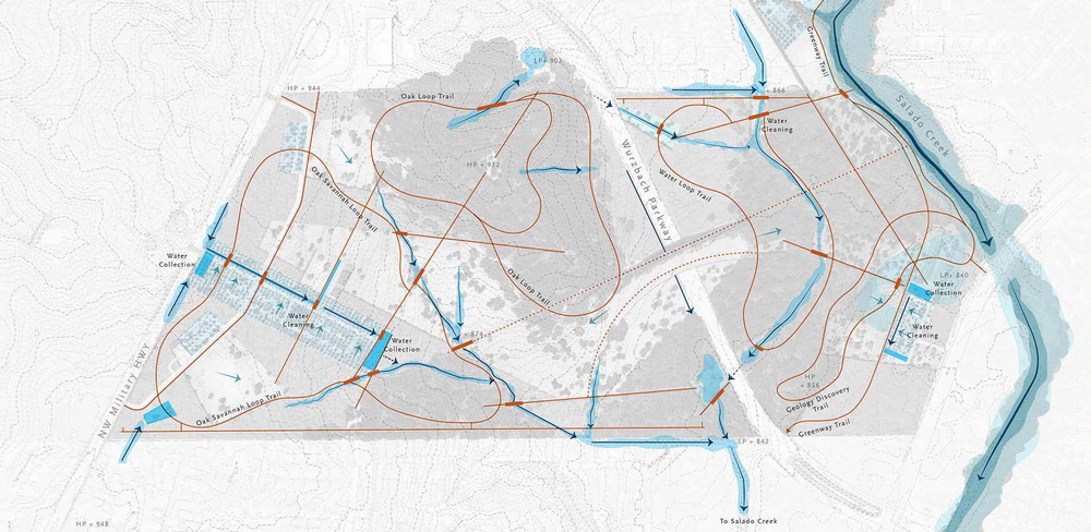
△ 超过8英里长的环道被小心翼翼地嵌入到修复的橡树草原、硬叶榆木树林和德克萨斯灌木丛中。区域内的水文系统构成了多变的生态环境的主干,引领游客穿过季节性的河流和旱谷。Over eight miles of loop trails are sensitively inserted in restored Oak Savanna, Cedar Elm Woodland, and Texas Scrubland. The site’s hydrology forms the backbone of these varied ecologies, choreographing visitors over seasonal creeks and arroyos.
Photo Credit: Stephen Stimson Associates
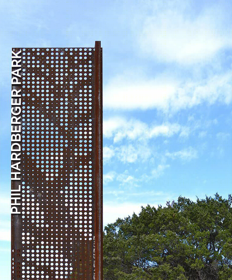
△ 标识系统是整个面积超过300英亩的公园中不可或缺的组成元素。指路标识的设计和尺寸是从德克萨斯州西南地区和公园作为“城市荒野”的概念中寻得灵感的。
Signage is an integral component throughout the three-hundred acre park. The design and scale of the wayfinding signage takes cues from the southwest region of Texas and the Park’s concept as an urban wild.
Photo Credit: Lauren Stimson
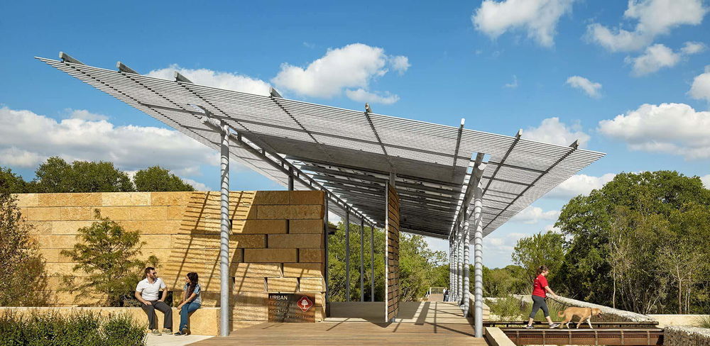
△ 城市生态中心是进入公园的门户。建筑师将其作为不可分割的景观要素来进行设计。配备太阳能发电、雨水收集、风暴清理和环保教育等功能。The Urban Ecology Center (UEC) is the gateway to the Park. The architecture was conceived as an integrated landscape element, with solar power, water harvesting, stormwater cleansing and environmental education.
Photo Credit: Casey Dunn
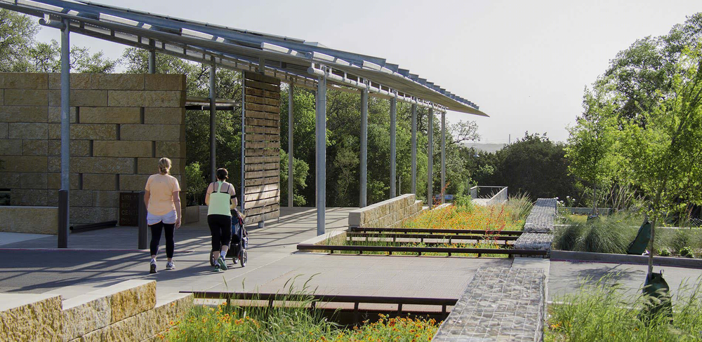
△ “大水渠”渗透、收集、净化UEC停车场的雨水。,这条800英尺长的生态洼地内种植着原生草类和野花,两侧是石灰岩笼网筑就的围岸。The “Grand Acequia” captures, cleansers, and infiltrates stormwater from the UEC’s parking lot. Over 800’ long, this bioswale is planted with native grasses and wildflowers, and edged by limestone gabions.
Photo Credit: Danny Watson

△ 雨水被收集起来用于演示示UEC的灌溉流程,整套程序会在紧挨着户外教室和野餐区的灰水庭院进行。Rainwater is harvested for the irrigation of the UEC’s demonstration pilots. This cycle is displayed in an intimate greywater courtyard, adjacent to the outdoor classrooms and picnic grove.
Photo Credit: Casey Dunn
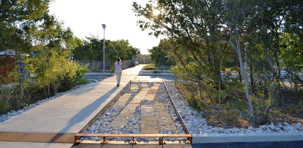
△ 雨水径流会在南部田野内被引向由本地石灰石精细建造的沉淀池。后者嵌入保持完好的灌木丛中,有助于减轻洪水暴发的危害。Stormwater runoff is diverted at South Field into carefully crafted sediment forebays of native limestone. Embedded within stands of preserved scrubland, these elements mitigate flash floods.
Photo Credit: Stephen Stimson
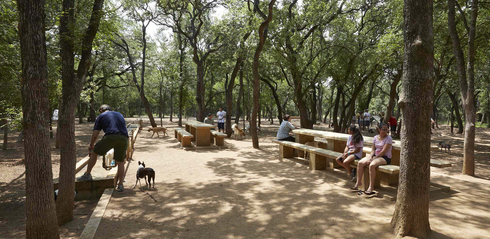
△ 野餐区被小心地安置在硬叶榆木林中,那里与用于聚会和游玩的南部田野相毗邻。这些区域为居住在周围人口稠密街区的居民提供所需的开放空间。Picnic rooms are carefully inserted into the Cedar Elm woodland adjacent to South Field for gathering and play. These areas provide much needed open space for the residents of the surrounding populated neighborhoods.
Photo Credit: Charles Mayer
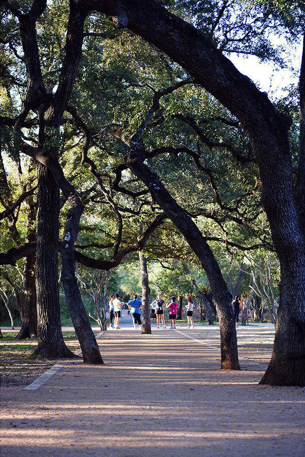
△ 萨拉多绿道两侧的高松树木被保留下来,提醒人们从自行车上下来进入步行区。Large stands of heritage Queurcus fusiformis are boldly preserved along the Salado Creek Greenway, acting as living reminders to dismount your bicycle through this pedestrian zone.
Photo Credit: Lauren Stimson
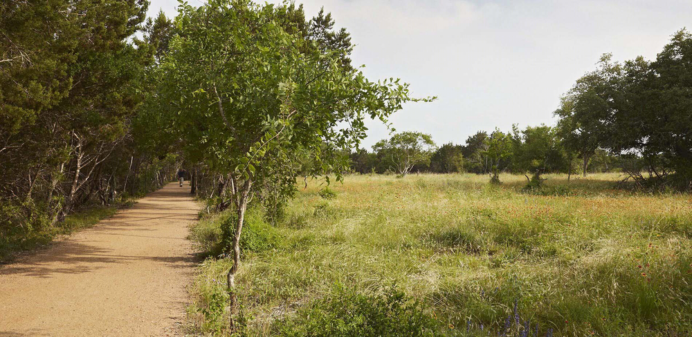
△ 开放的橡树草原试验田种植者超过30个品种的原生草类、多年生植物和阔叶草本植物,促进了草原的生物多样性和生态韧性。Over thirty species of native grasses, perennials and forbs were planted in the Open Oak Savanna test plots, boosting the savanna’s biodiversity and resilience.
Photo Credit: Charles Mayer
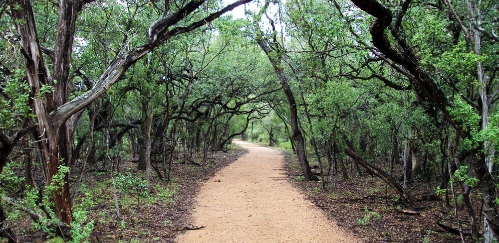
△ 设计精致的花岗岩碎石小路小心翼翼地穿插在灌木丛中,为游客提供身临其境的景观体验。Delicate decomposed granite trails weave carefully through scrubland and provide an immersive experience for visitors.
Photo Credit: Lauren Stimson
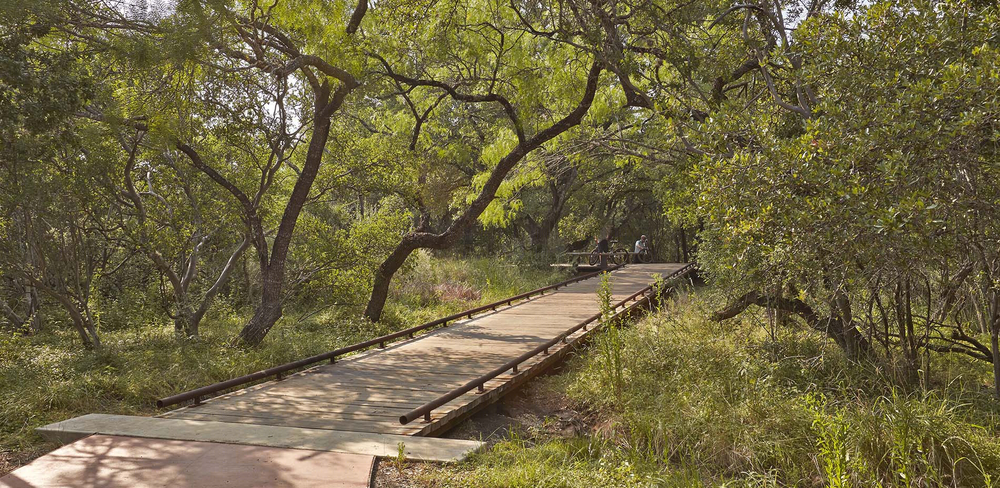
△ 跨在水面上的木板路随机出现在公园各个角落,将路径系统延伸到原先神秘未知的区域内,营造游客与敏感的季节性水道景观之间的互动。Water crossing are sited at distinct locations throughout the Park, expanding the trail system into previously unchartered areas, and creating the interactive movement of visitors over sensitive seasonal waterways.
Photo Credit: Charles Mayer
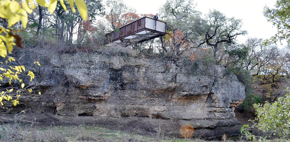
△ 萨拉多河观景平台悬挑在季节性洪水景观的上方,让游客能在观赏曝露在外的喀斯特地貌和河床上的野生生物。The Salado Creek Overlook cantilevers over a seasonally flooded landscape, allowing for the observation of exposed karst geology, and creek bed wildlife.
Photo Credit: Lauren Stimson
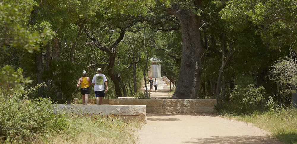
△ 路径的起点和终点与萨拉多河步道口重叠,出现在那里的储水箱是公园对雨水定点收集和储存系统的展示。Trails begin and terminate at the Salado Creek Trailhead, a water tank basin station that expresses the collection and retention of water.
Photo Credit: Charles Mayer
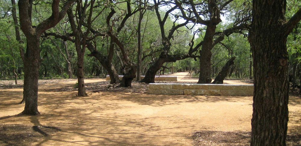
△ 高耸的栎木受到具有侵略性的继发性灌木丛的威胁。通过在城市范围内推广环境规范,这些树木在一系列表彰生态社区的“路遇上树”项目中得到保护和看顾。Large stands of heritage Queurcus fusiformis are threatened by aggressive successional brushland. Cultivating a City-wide environment ethic, these trees are enhanced and preserved through a series of ‘trail and tree encounters’ that celebrate these ecological communities.
Photo Credit: Lauren Stimson
PROJECT NARRATIVE
Site and Context
In 2007, Mayor Phil Hardberger and the Parks and Recreation Department of San Antonio, Texas led an international design competition for a newly acquired parcel of land in the northern reaches of the City. As winners of the competition, the design team was charged with master planning and designing a 21st century park for the seventh largest city in the United States. At 311 acres, the site was the largest parcel of undeveloped land in San Antonio and has become the most significant public park project in the City since 1899. Positioned in the heart of a major population center, the Park provides greatly needed open space in an urban environment where the acreage of parks per person is below the national average.
Uniquely positioned at the convergence of three ecoregions, the South Texas Plains, the Blackland Prairie and the Edwards Plateau, the site offers a rich mosaic for landscape restoration, from heritage oak woodland to endangered oak savanna. As a former dairy farm, it also exhibits remnants of the agrarian patterns of grazing and farming which are unique to the historic settlement of San Antonio’s missions. Hardberger Park was the first public park to be master planned in the City of San Antonio and generated intense community interest. From the onset, the design team was charged with planning for a city-wide park, and engaged in a unique process of community meetings and public work sessions throughout 6 precincts of the city. This public process continued through subsequent design phases, where the Design Team presented Park design proposals to the Public, the Parks Board, and Historic District Commission for review and approvals.
The conceptual framework for Hardberger Park as a ‘cultivated wild’ designates 75% of the parkland as a renewed native landscape mosaic. This involves the preservation of heritage oaks, the restoration of woodlands and brush, and the reintroduction of the endangered oak savanna, the expansive native grasslands that personify a genuinely wild Texas territory. The remaining 25% of parkland is comprised of active areas for community gatherings and varied recreation carefully embedded in the native and restored landscape. The crafting of places takes inspiration from the City’s cultural landscape, reinterpreting patterns of historic mission acequias and cultivated fields. The result is park programming that respects its natural context creating a dynamic relationship between built and natural elements.
The Park is bisected by a six-lane vehicular Parkway and divided into two parcels. The east side is bordered by the Salado Creek, linked to the regional park system by the Salado Creek Greenway, and has a low-lying cedar elm woodland and scattered with oak mottes. The west side is characterized by overwhelming scrubland and invasive species, a high knoll of live oak woodland, and exposed limestone. Dense neighborhoods and development surrounds the Park on all remaining sides. Existing drainage culverts provide wildlife corridors under the Parkway and connect the two parcels. Eventually, a monumental land bridge will re-connect these two parcels. When the design phase began, a small herd of cows were still grazing on the property, but the majority of the site was covered with impenetrable brushland. These dense thickets of understory had almost entirely succeeded the native savanna grasslands and were choking out the remnant heritage oak mottes and cedar elm woodland. Preserving the heritage woodlands, managing the scrubland, and restoring the native oak savanna became a primary design goal. This holisitic restoration process was integrated with the program of parking for 350 cars, picnic groves, playfields, playgrounds and dog parks on both parcels.
On the east, the Salado Creek Classroom and Trailhead is a 2,400 sq ft Park facility with restrooms, offices, an outdoor classroom and interpretive space powered by solar panels and rainwater harvesting. The building serves as the Park’s headquarters and a gateway for the Salado Creek Greenway. Further north along the Greenway corridor, the Salado Creek Overlook is a 60’ long weathering steel and aluminum structure that hovers 40’ above the creekbed. For years, the City turned its back on these ephemeral waterways by burying and culverting them. This reach of the Creek is re-naturalized and has unique karst features along the bluff edge, made visible from the Overlook where interpretive signage depicts the Park’s geologic history. On the west, a five-acre play field was carefully carved out of the scrubland and is used for passive recreation and public art display. The field was seeded with drought tolerant native fescue grass mix and was recently the site of the Tom Otterness sculpture installation Making Hay. The Master Plan designates 60 acres of the west side to restored oak savanna which will be implemented over time. The Parks and Recreation Department selectively cleared a six-acre test plot, and over 40,000 native plugs were planted by City-wide volunteers.
Over six miles of trails, constructed primarily of native decomposed granite with an organic stabilizer weave carefully throughout the woodlands and connect the new program spaces on both parcels. Boardwalks were created where trails cross watercourses, and the trail system respects existing large stands of heritage live oaks, persimmon and cedar elm, preserving these ecological communities in ‘trail and tree encounters.’ A comprehensive signage package was designed by the Landscape Architects and included two main entry signs, loop trail signs, wayfinding signs, and interpretive signage. The use of materials common to the region such as Leuders limestone, sandblasted concrete, raw steel, salvaged drill stem pipes, and cedar staves, demonstrates the respect for the native San Antonio landscape and connect the project to its regional context.
The west side of the park provides the community with a gathering place for both recreation and education with the introduction of an 18,600 sq ft Urban Ecology Center. This state-of-the-art facility encompasses indoor and outdoor classrooms, a gathering hall, restrooms, picnic areas and parking, all designed and constructed to LEED standards. The Architect and Landscape Architect closely collaborated to ensure the building was embedded in the existing oak savanna and scrub landscape. A unifying element is the ‘grand acequia’, lined with limestone gabion and weathering steel that captures and collects all of the parking lot runoff. This 600’ long bioswale is planted with native forbs and grasses, traversed by vehicular and pedestrian bridges, and provides a model for how large-scale landscape gestures can and should replace conventional stormwater infrastructure.
The Master Plan for Hardberger Park was completed and adopted by San Antonio’s City Council in May 2008. Within three months, Phases IA, IB, and II were simultaneously in progress. The Hardberger Park Conservancy was founded, and $2.0 million in state grant money was awarded by the Texas Parks and Wildlife Department for construction. The Park had a series of phased openings and has been open for City-wide use since 2010. This project exhibits a commitment to native landscape and habitat restoration, green infrastructure, connectivity to regional open space and human fitness. Hardberger Park is an important milestone in the history of park-making in Texas, and offers a new model for embracing suburban ecology, and has become a living laboratory for healthy living and sustainability in south Texas.
MORE:
ASLA
Stephen Stimson Associates Landscape Architects
,更多请至:

